 16°C
16°C


LOCATION, ORIGIN, TOPOGRAPH
 In the very heart of POMERANIA, in the eastern part of DRAWSKIE LAKE DISTRICT, there spans, a uniquely beautiful and abundant in peculiarities, Szczecinek Region with the town of SZCZECINEK inhabited by 40,000 people. The varied topography of the land was affected to a large extent by the last glaciations known as the Baltic glaciations 10,000-12,000 years ago. The glacier shaped the splendid postglacial landscape with multiple hills and mounds of the terminal moraine. The following tops are the highest: POLSKA GÓRA - 203 meters above sea level (masl); KALSKIE GÓRY - 185 masl; LASKIE GÓRY - 174 masl; GÓRA KUKULICA – 169.3 masl; JAMIENSKIE GÓRY - 168 masl; DEBOGÓRA – 167.5 masl. Among the postglacial hills and moulds, and in the zone of the undulated ground moraine, the precious treasures of this land, i.e. ribbon lakes, ground moraine lakes and cave-in lakes, are scattered over the whole area. Ribbon lakes are elongated, have large water surfaces, are deep and boast well-developed shorelines, e.g. TRZESIECKO Lake (134.1 m above sea level, area of 295.1 ha, 11.8 m deep, 5.6 km long), DOLGIE Lake (137.4 m above sea level, area of 310.8 ha, 19.8 m deep, 8.5 km long).Among the reservoirs of the ground moraine with large areas, oval shapes and generally not very deep, the following lakes are the largest: WIELIMIE Lake (132.6 m above sea level, area of 1754.6 ha, depth – 5.5 m, length – 6.4 km, width - 5 km), the second largest lake of DRAWSKIE LAKE DISTRICT, and WIERZCHOWO Lake (139 m above sea level, area of 731 ha, depth – 26.5 m, length – 5.2 km, width – 2.3 km).
Cave-in lakes seated in deep marvellous valleys have small areas and are oval-shaped, e.g. JAMEN Lake and SMADOWO Lake. The place where lakes are the most numerous and the most varied is ”JEZIORA SZCZECINECKIE” [“THE LAKES OF SZCZECINEK”] protected landscape area spanning over 18,000 ha, located in the northern part of the MUNICIPALITY OF SZCZECINEK. The abundance of lakes fabulously integrated with the landscape of forests, fields and meadows is accompanied with the profusion of rivers, brooks and other watercourses. THE MUNICIPALITY OF SZCZECINEK is a staring point of multiple rivers: GWDA, PARSETA, PLYTNICA, DOLGA, OSOKA, and PERZNICA. As they flow through the picturesque valleys and numerous lakes, they combine into breath-taking watercourses. [ckeditor_pg_embed:1570]
The abundance of varied, both small and large, concave and convex, new topographical forms are the evidence of the exceptional beauty of the postglacial landscape. HISTORY The history of the Szczecinek Region was turbulent. The first settlements in this region date back to the Bronze Age. In 10th – 12th century Slavs established their towns here. In the second half of the 10th century, MIESZKO I subdued the whole Western Pomerania and incorporated it into Poland. Later on, the Pomeranian dukes gained autonomy, but remained under significant influence of their neighbours: the Mark of Brandenburg, the Teutonic Order and Poland. In 1310, WARCISLAW IV, the duke of Pomerania, founded the town of SZCZECINEK. A castle was built on the isle near the shore of TRZESIECKO Lake. BOGUSLAW V, the son of WARCISLAW IV, fostered close relations with Western Pomerania whose borders went along the southern frontiers of the Land of Szczecinek and sealed his commitment with the marriage with ELISABETH, a daughter of a Polish King KAZIMIERZ III THE GREAT. Duchess ELISABETH died in 1361 and was buried in the MARIENTRON monastery on TRZESIECKO Lake. In 1640, Duchess JADWIGA BRUNSZWICKA founded a secondary school in SZCZECINEK so called gimnazjum, one of the first schools of this type in Pomerania.
The Duchy of Western Pomerania perished in 1637 when the last member of the House of the Gryfits, Duke BOGUSLAW XIV, died. The Szczecinek Land was incorporated into BRANDENBURG and later PRUSSIA. The second half of the 19th century and the beginnings of the 20th century mark the era of the fast development of the Szczecinek Region. Macadam roads were built, the first railroad was constructed between 1878 and 1879, new industrial sites were established, commerce flourished and multiple public edifice were erected. Before World War II, Szczecinek, with 20,000 residents, was a well developed town. It was a successful holiday resort. The Szczecinek Region was traversed by a belt of military fortifications built by Germans before World War II and known in German as the POMMERNSTELLUNG. As a result of the hostilities, towards the end of World War II, on 27 February 1945, Szczecinek was captured by the Soviet troops.
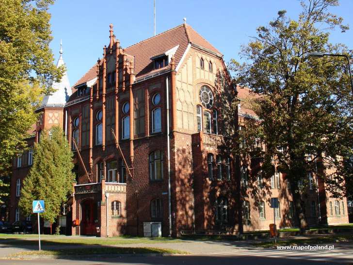
 The land abandoned by the Nazis was now occupied by repatriates from the eastern borderland of the pre-war Poland now a part of the USSR. In the post-war era, the region developed in economical terms. Wood, food and electrical industries expanded. New housing estates, health centers and community centers were erected. HISTORICAL BUILDINGS IN SZCZECINEK The Castle of Pomeranian Dukes situated on the peninsula of TRZESIECKO Lake. was repeatedly rebuilt. The oldest part is the southern wing dating back to the 14th century. In the 17th century, it was a legacy for widows bereaved by deceased dukes. The Gothic tower is the remnant of St Nicholas’ Church dating back to the 14th century; the nave was demolished in 1909. In 1914, the tower was converted into the Regional Museum which still remains the seat of this museum. The town hall was erected in 1852 in an eclectic style with neo-Romanesque elements. Today, it is a seat of the Town Office. The neo-Gothic Church of the Birth of the Holy Virgin built in the years 1905 - 1908 boasts a 78-meter tower. The chancel accommodates magnificent neo-Gothic glass stained windows with eight scenes from the Christ’s life and neo-Gothic winged altarpiece.
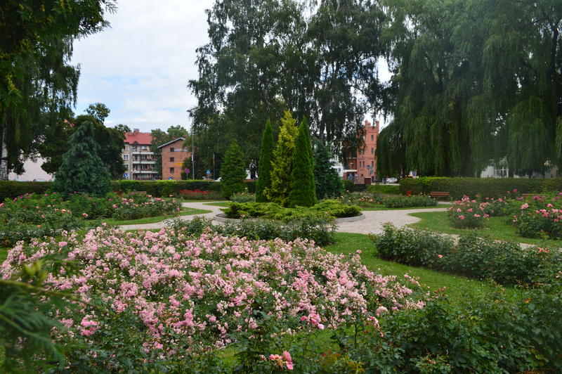
Pipe organs on the organ gallery with 1670 pipes. The building of the former gimnazjum erected at the beginning of the 19th century was repeatedly rebuilt. In 1640, Duchess JADWIGA BRUNSZWICKA founded here a secondary school, so called gimnazjum, one of the first schools of this type in Western Pomerania. The Church of the Holy Spirit was constructed in 1923 by the Catholics and was called the Polish Church. The municipal park located on the northern and eastern shore of Trzesiecko Lake was established in the years 1875 - 1908 in an eclectic style. Bunkers along the western and northern outskirts of Szczecinek; fortifications known as the POMMERNSTELLUNG with 24 reinforced concrete multi-purpose bunkers erected in the 1930’s. After World War II, the bunkers were blown up. ON THE TRAIL The tourist center of the Szczecinek Region is the town of Szczecinek, with 42,000 residents, magnificently spanning over the depression between two fathomless large lakes: WIELIMIE and TRZESIECKO, coupled by the NIEZDOBNA River. The town, surrounded by moulds, woods and open spaces of fields and meadows adjoins the northern and eastern shore of TRZESIECKO Lake.
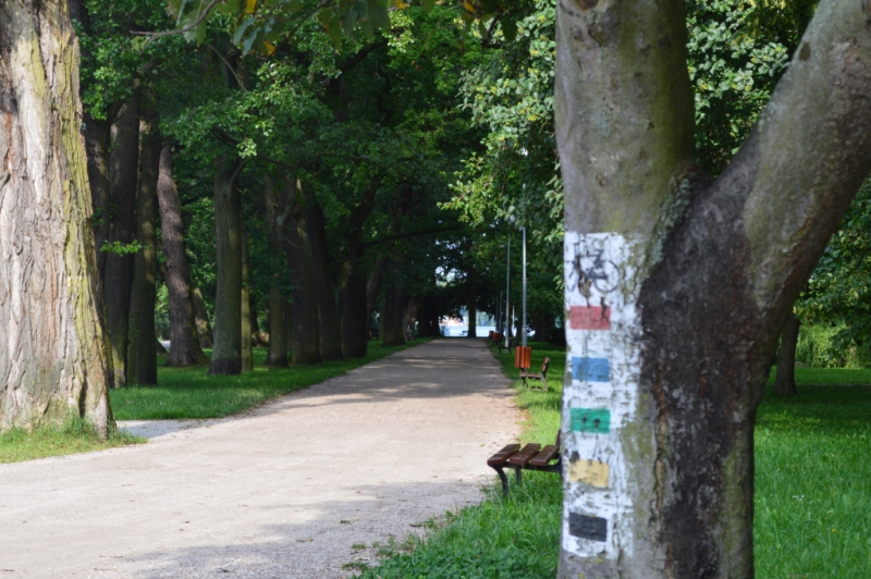
It flows down with the web of old streets towards an old lakeshore park extending along the shoreline of TRZESIECKO Lake. The meeting point of the bike trails is located in the direct vicinity of the historical town-center complex, in the park, where Ks. ELZBIETY Street meets the shoreline of TRZESIECKO Lake, near the building of the Comprehensive Secondary School. Five bike trails set off on the shores of the lake: red-coded – THE LAKES OF SZCZECINEK – 65.1 km, green-coded – THE VALLEY OF THE PARSETA RIVER – 51.1 km, yellow-coded – MAGICAL LANDSCAPES – 51.7 km, blue-coded – AROUND TRZESIECKO LAKE – 14.5 km, black-coded – NIZICA – 42.2 km They break away from the town through beautiful park alleys surrounded by exotic trees and bushes stroked by flsh of the glistening lake waves.
[ckeditor_pg_embed:1569]
They cross the spectacular and mysterious land of moulds, hills, forests and enigmatic lakes hidden in valleys. They meet other bike trails starting and ending in Bialy Bór, Barwice and Borne Sulinowo. The red „LAKES OF SZCZECINEK” trail meets the blue „HIDDEN LAKE” trail heading for BIALY BÓR. The green„VALLEY OF THE PARSETA RIVER” trail converges on certain sections with the red „HILLS OVER THE PARSETA RIVER” trail and head for BARWICE and „TO CIEMINO LAKE” trail running to BORNE SULINOWO. The black„NIZICA” trail meets the red „TO CIEMINO LAKE” trail and a crossing of trails in BORNE SULINOWO. They are marked with a black silhouette of a bicycle and a rectangle in the colour of the trail on a white square.
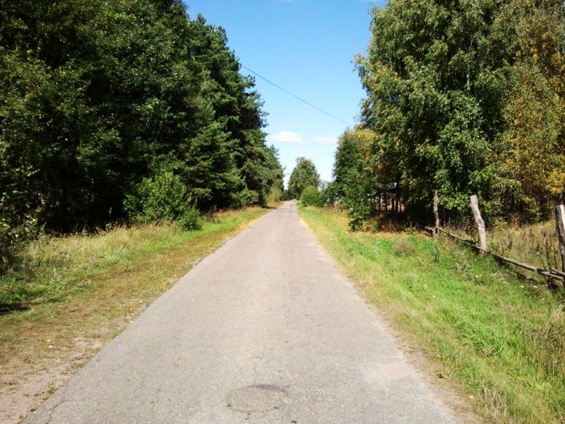
They bypass main passageways which usually lead through narrow asphalt roads off the beaten track. The time needed to cover a given trail at a slow speed making the best of all attractions on the trail; including the time to stop over and do some sightseeing is not longer than one day. Try to plan a biking outing on a bright and sunny day, not too windy. In the sun, the world looks brighter and more colourful. Biking should be fun. Do not hurry and leave your watch at home. Remember not to take too much baggage. It should be immobilized on the baggage carrier so that it does not absorb your attention. Food supplies are not a problem as some grocery is open all day in almost every village. The slower you move, the more you will see and remember and the deeper your experiences. Landscapes look surprisingly different in each season or time of day. Spring brings about an amazing outburst of pastel green, rupturing buds of trees and shrubs.
Damp meadows turn into blossoming colourful carpets of flowers. Aerial travellers nest and chirp singing their cheerful love serenades. In summer, the warm waters of the lakes lure to explore the over- and underwater gardens. Just before an unexpected storm, the astounding scent of herbs permeates the vast open areas of fields and meadows. It is the time of harvesting crops and forest fruit. Before the summer is over, the mushrooming season is on. Indian summer spins its web. The multicolour, ornamental autumn, dressed in brown, yellow, red and violet gown of leaves will come soon. The colourful veil will fall soon and you will be left only with colourful memory slides. You will set off on the trail again when spring comes.
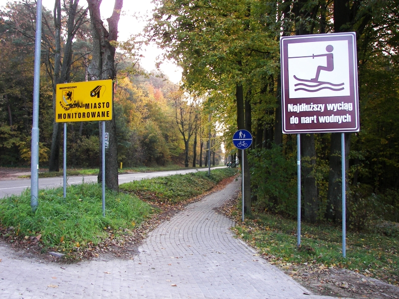
THE LAKES OF SZCZECINEK SZCZECINEK •
BUGNO • GALOWO • TRZCINNO • SPORE • STEPIEN • DREZNO • ORAWKA • STARE WIERZCHOWO • WIERZCHOWO • TRZEBIECHOWO • KUSOWO • DALECINO • TRZESIEKA • SZCZECINEK Trail length – 65.1 km Red-coded The „LAKES OF SZCZECINEK” bike trail runs through a magnificent protected landscape area „LAKES OF SZCZECINEK” north of SZCZECINEK, with the area of18,000 ha. Between two enormous lakes of the ground moraine, WIELIMIE Lake and WIERZCHOWO Lake, among the abundance of moulds and hills, up the GWDA River, there spans a wonderfully configurated area cut with deep valleys and smaller watercourses. The bike trail runs near 15 lakes and crosses the GWDA River three times. Moss and lichen-covered maple, sycamore, lime or oak lanes connect villages where, in the shade of old trees, little old churches, palaces and mansions sleep. The view from the postglacial moulds is magnificent, especially from POLSKA GÓRA [POLISH MOUN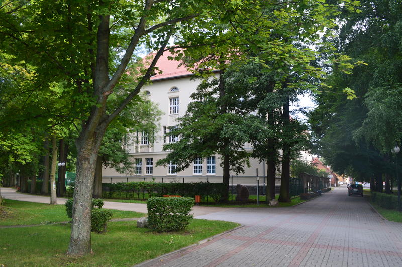 TAIN](203 m above sea level), the highest peak in the northeast of DRAWSKIE LAKE DISTRICT.
0.0 km - The „LAKES OF SZCZECINEK” bike trails starts in the starting point at the building of the Ks. Elzbiety Comprehensive Secondary School, where Ks. ELZBIETY Street meets the shoreline of TRZESIECKO Lake. It runs along a trail in the municipal park to the northwestern direction accompanied by bike trails: green „THE VALLEY OF PARSETA RIVER” trail heading in the same direction and yellow „MAGICAL LANDSCAPES” trail, black „NIZICA” trail and blue „AROUND TRZESIECKO LANE” trail, which run in the opposite direction. Behind the fence of Comprehensive Secondary School, you can spot the monument of JAN SAMUEL KAULFUSS, which commemorates one of the most eminent headmasters of the school who died in 1832. 0.2 km – You pass along a marina, and surrounded by large alders, ashes and oaks, at 0.6 km, reach LABEDZIA WYSPA(Swan Isle), connected with the shore by a wooden bridge. 0.7 km – You leave the municipal park and go to JEZIORNA Street via ORDONA Street. You pass the crossroads at T. KOSCIUSZKI Street 1.0 km – You turn left at the next crossroads to KOSZALINSKA Street and leave the yellow „MAGICAL LANDSCAPES” trail at the crossroads. 1.5 km - Going down KOSZALINSKA Street, on the left you go past MYSLIWSKA Street and a garrison church with the exhibition of military equipment.
1.7 km - MECHANICAL SCHOOLS COMPLEX on the left. 2.1 km - Through KOSZALINSKA Street the trail reaches the crossroads of G.NARUTOWICZA Street (municipal ring road) and runs straight northwestward to BUGNO. 2.4 km - From the bridge over SZCZECINEK-to-BIALOGARD railroad, you will see a fragment of the bay of WIELIMIE Lake and, to the northwest, a tree-clad hill (156.4 m above sea level) with a few hidden bunkers of the POMMERNSTELLUNG fortifications. WATER PURIFICATION PLANT straight in front of you. 2.8 km - The trail runs to the north through BUGNO Street close to „ELDA” Installation Equipment Production Plant. 2.9 km - „TELZAS” plant manufacturing power supply devices. Opposite, to the south, you will spot the bay of WIELIMIE Lake with the isle of cormorants. The remnants of two bunkers are located between the road and the lake shore. 3.2 km - In the village of BUGNO, to the right from the trail, an old mansion dating back to the second half of the 19th century is situated among old chestnuts, limes, oaks and beeches. Behind the mansion, there is a park with grand oaks 3.45 m and 3.3 m in perimeter; lime trees – 2.7 m in perimeter; beeches – 2.85 and 2.5 m in perimeter; and a lot of hornbeams 2.25 in perimeter; as well as ashes, maples and spruces. 3.4 km - You leave SZCZECINEK behind through a lane surrounded by maples and ashes.
3.8 km - The asphalt road marks the border of the bottom of a postglacial valley and crosses the fortifications of the POMMERNSTELLUNG A blown-up bunker on the right to the road. A series of bunkers located to the south and west on tops of moulds. 5.0 km – From the hill, 148.5 m above sea level, just in front of the village of GALOWO, you will relish a spectacular view of the bay of WIELIMIE Lake and of the town of SZCZECINEK. 5.4 km - A long drive downhill near the old farm buildings and the neoclassicist mansion house from the 19th century leading from a postglacial upheaval Behind the mansion, you will find a wild, mysterious naturalistic park with the area of 1.5 ha with magnificent specimens of such trees as oaks 5.5 m; 3.5 m; 3.1 m in perimeter ; a large cluster of elms 3.6 m; 3.5 m; 3.1 m; 3,05 m in perimeter. An ancient lime broken at the height of 8 m and empty inside,
4.3 m in perimeter is an unusual view. The park also boasts chestnuts, ashes, beeches, hornbeams and maples. 6.1 km - Having passed by the park, the remains of the lane overgrown with maples and sycamores lead us among meadows to the major part of the village of GALOWO that you dash through near a wooden cross and a stork’s nest on the power line pole. 6.4 km - Just behind the village, you blend into the thicket of the Galowo forest which is predominated by sky-towering beeches. 7.3 km - The forest ends and a maple and sycamore lane runs towards the village of TRZCINNO, situated among fields and meadows of the valley of WIELIMIE Lake. 8.3 km - At the entrance to TRZCINNO, on the left, you will spot a red brick mansion house without features of any particular style, and the remains of a park. 9.1 km - From TRZCINNO, the red bike trail runs through the maple and sycamore trail to the verge of the postglacial depression area. It crosses the stream and ascends to the ridge of the upheaval (10. km), 143.8 m above sea level. The hill offers a magnificent view of POLSKA GÓRA Hill to the west. 11.5 km - After ascending another, the highest, hill – 149.2 m above sea level, you have to turn right behind the bus station to the east and enter a sandy dirt road.
11.8 km - You reach the edge of a fabulous, deep, postglacial valley whose bottom is occupied by the upper gorge section of the GWDA River. 12.0 km - The rocky road zigzags towards the concrete bridge on the river near the stage of fall, the remnant of the watermill, and climbs to the steep opposite slope of the valley. 12.4 km - From the top of the hill, next to the old Protestant cemetery, you can delight in a wonderful view of the holiday resort called SPORE, beautifully situated in a lowered part of the land between the GWDA River and the trough of SPORE Lake (total area: 90 ha; depth: 7.4 m; lakeshore length: 7.2 km; 137.9 m above sea level). Going along an asphalt road you blend into the buildings of the village. On the right, you go past „SPORE 51” Holiday Center and „Alex” agrotourism farm. 12.7 km - You cross the stream through which the surplus water from SPORE Lake and SPORE MALE Lake is released. On the left, you will spot „WODNIK” Holiday Center. 12.9 km - Just in front of the grocery and mini-bar, the bike trail turns right and climbs to the edge of the postglacial valley. 13.0 km - On the left, on a nearby hill there is a neo-Gothic Holy Family Church dating back to the second half of the 19th century, made of stone and brick. 13.1 km - On the edge of the lake valley, the asphalt road changes into a soil-surfaced road. It offers a magnificent view of SPORE Lake and holiday bungalows. You have to turn left at the fork of dirt roads. It runs through fields to the northeast in a slightly undulating land. 13.4 km - It crosses straight on the crossing of soil-surfaced roads. 13.8 km - In front of the forest, it arrives at the edge of a small valley with three small ponds. The first water surface glistens on the left of the trail, and two more ponds are hidden in the forest on the right. Further on the trail leads along a dirt road (stony uphill driveways) to the northeast direction through a vast forest complex of coniferous trees.
14.7 km - Beyond the valley of the three ponds, you will see a descent to yet another postglacial valley whose bottom is occupied by a stream flowing from the hidden PLOCICZNO Lake. Overgrown with plants and inaccessible PLOCICZNO Lake (area: 25 ha; depth: 4 m; lakeshore length: 0.9 km; 137.4 m above sea level), an enclave of peace and quiet, is situated on the right of the trail in a small postglacial vale. Making your way through the resinous pine woods, to the east you spot the shimmering surface of PLOCICZNO Lake.17.0 km - You reach the crossing of forest lanes. The bike trail turns right to the southeast direction towards the high 4-meter juniper shrubs. 18.1 km - At the end of the forest lane, you will come across another crossing of dirt roads and a vantage point where you can admire the valley of a small DOLGIEJ River, starting from the visible MLYNSKIE (STEPIENSKIEGO) Lake (area: 36.7 ha; depth: 33.1 m, 139.8 m above sea level).
18.4 km - You turn left to a sandy road and go down to the valley bottom to the settlement of STEPNO, situated at the small bridge over the DOLGIEJ River („SZCZECINEK LOOP” canoeing trail). You make it to the little postglacial valley and along a dirt road you head east to the village of STEPIEN. 19.5 km - The village of STEPIEN spans along the southeastern shore of KACKO (FOLWARCZNE) Lake (area: 34 ha; 139.8 m above sea level). The heart of the village is a small old half-timbered 17th-century Christ the King Church on the hill surrounded by a little low wall. The church interior entails a Renaissance, slightly Flemish in style, polychromed alter dating back to the 17th century with a painting of the Resurrected Christ in the finial and folk sculptures of St Peter and St Paul. In the western part, the church boasts a wooden tower covered with a three-storey tin cupola. 19.8 km - The bike trail passed the church on the western and northern side and joins the„HIDDEN LAKE” bike trail which starts and ends in BIALY BÓR. 20.8 km - The trail leaves STEPIEN through a road cobbled with red granite cubes and next through asphalt road. It runs through a beautiful trail surrounded by maples and sycamores northwestward to the village of DREZNO.
21.6 km - Close to the asphalt road, near MLYNSKIE Lake, you will catch sight of an agrotourism farm which offers rooms for rent, horse-riding facilities and access to the lake. The bike trail running along the border of the forest and fields is a starting point on the left of three dirt roads which lead to the passage between the nearby MLYNSKIE Lake and DEBNO (DAMSKIE) Lake (area: 61.1 ha; depth: 7.5 m; 140.2 m above sea level).
 24.5 km - From the road surrounded by maples and sycamores, on the left you will spot glimmering waters of LAKOWE (NOWE JEZIORSKO) Lake (area: 61.1 ha; depth: 6 m; 139.7 m above sea level). 25.8 km - You enter the village of DREZNO, situated at the mouth of BIELEC stream to STUDNICA (DREZNO) Lake (area: 101.7 ha; depth: 24.9 m; 139.4 m above sea level). You leave the blue bike trail . 26.1 km - Behind the concrete bridge (stage of fall being a remnant of a watermill) over the small BIELEC River, which flows through a charming valley, a dirt road goes left to the scout hostel of the Scout Troops of Szczecinek and a campsite located on the eastern shore of STUDNICA Lake. 26.2 km - On the right of the lane, under a forked maple, you can delight in a roadside small shrine with the sculpture depicting Holy Mother. 26.3 km - A maple and sycamore trail with asphalt pavement leads out of the village of DREZNO through the forest to the northwest direction. 28.6 km - By the northeastern shore of the magnificent ground moraine lake -WIERZCHOWO (are: 731 ha; depth: 26.5 m; lake shore length: 20 km; 139.0 m above sea level) you leave the asphalt road and turn right into a stone-surfaced road leading to the southwestern direction to a settlement called ORAWKA. 29.8 km - You enter ORAWKA, beautifully situated on the passage between the lakes of STUDNICA and WIERZCHOWO, where their waters are joined by the GWDA River.
29.9 km - Behind the bridge on the GWDA River, on the left, a Holiday Center is located on the shore of STUDNICA Lake.  On the other side of the stone-surfaced road, there is a campsite on the shore of WIERZCHOWO Lake. 30.6 km - The trail leads on a stone-surfaced road along the passage between lakes at the foot of DRAWSKA GÓRA Hill that reaches the height of 166.6 m above sea level. There is a second campsite on the shore of WIERZCHOWO Lake with a fabulous natural sandy beach. 31.3 km - Going along a soil-surfaced road to the south to a small village of STARE WIERZCHOWO, on the left, in a hollow in the ground, you go by a tiny lake and leave the forest. 33.0 km - The village of STARE WIERZCHOWO founded in 1579 on the GWDA River, welcomes you with a beautifully renovated frame-construction peasant cottage and a stork’s nest at the backdrop of a church tower overwhelming the surrounding landscape. At the branching of the roads, you will spot a neo-Baroque Church of Our Lady of Good Counsel dating back to the 18th century. In the 19th century the western part of the nave was extended with a half-timbered tower covered with a tin dome-shaped cupola. Inside the church, you can admire a wooden ceiling and organ gallery with organs supported on two wooden pillars.
33.5 km - Over the stone bridge on the GWDA River, the asphalt road runs to the west through the forest. 36.1 km - Behind the forest, just ahead of the buildings of the settlement of WIERZCHOWO, the bike trail turns right to the northwestern direction into a field way leading northwest to the village of WIERZCHOWO.
 37.0 km - You go past a small pond overgrown with white water-lilies, hidden on the left of the trail in a small forest vale. 38.1 km - You enter the village of WIERZCHOWO. The pavement of the road is asphalt. The village of WIERZCHOWO, whose original name, VIRCHOWE, was knows as early as in 1295, spans along the ridge of a hill between two lakes: WIERZCHOWO and WIERZCHÓWKO (area: 35.8 ha; depth: 2.8 m; 3 islands; 139.8 m above sea level). In the highest point, you will spot the brick and plastered Church of the Assumption of the Holy Virgin dating back to the 18th century. On the western side, there is a tower built on the nave and is topped with a tin hip roof. Inside two rows of columns support a wooden ceiling. Next to the church, there is a half-timbered 18th-century belfry covered with a pavillion roof with a bell dating back to the first half of the 17th century. 38.8 km - The bike trail reaches the highroad from SZCZECINEK to BOBOLICE and turns into it to the left, and further, 100 m to the right, it turns to an asphalt road leading southwest to TRZEBIECHOWO.
39.1 km - To the north away from the bike trail , near the southern shore of WIERZCHÓWKO Lake, you encounter a palace park with old oaks and beeches. 39.4 km - A superb view of WIERZCHÓWKO Lake at the fork of asphalt roads. You can catch a glimpse of a swinging ocean of hills, hillocks and rises separated by a variety of postglacial valleys. The bike trail goes straight southwestward, in the shade of an old maple and sycamore lane. 42.4 km - Another fork of asphalt roads and the bike trails slopes down southwestward to the bottom of a deep valley of the PERZNICA River (a right tributary of the PARSETA River) which enters the nearby TRZEBIECHOWO (LUTOWO) Lake. Huge ancient oaks growing alone among fields become more and more frequent. You enter the kingdom of oaks. 42.9 km - On the southwestern slope of a postglacial valley, you will submerge in an impressive 1100-meter-long oak lane (with oaks 3.5 m in perimeter) which leads through a fantastically uplifted area past the village of TRZEBIECHOWO.
43.3 km - The oak trail blends with the buildings of the village of TRZEBIECHOWO situated on the western shore of TRZEBIECHOWO (LUTOWO) Lake (area: 89.2 ha; depth: 8 m; 137.2 m above sea level). Enormous oaks and beeches grow among peasants’ cottages and houses. Two towering oaks 6.8 m in perimeter (with a burnt-out trunk) and 4.85 m in perimeter are of special interest. Along the western shore of TRZEBIECHOWO Lake, there spans a magnificent, naturalistic 8-hectare park with wonderful numerous specimens of beeches and oaks. In the park on the lakeshore, you spot a beautifully renovated English gothic style palace from the turn of the 20th century. Between the palace and the lake, there is one of the oldest oaks in Pomerania whose age is estimated at 500-600 years and impressive perimeter of 8.45 m. Near the palace on the northwestern side, behind the village buildings and among old park trees, you will encounter a neo-Gothic Church of Our Lady of Czestochowa dating back to the 19th century. 43,7 km - You leave TRZEBIECHOWO through an oak lane and flash via a narrow road southward to KUSOWO. You go down to the bottom of a deep vale surrounded first by huge oaks and later by ashes. On the left, the tops of high-rising hills are overgrown with olden beeches and oaks. Sneaking through a maple and sycamore lane, to the west you will go past the range of LEKOGÓRA hill. The surrounding fabulously undulating landscape chops and changes. 46.5 km - Under the roof of the branches of maple and sycamore trees you enter the village of KUSOWO situated on two small lakes.
46.7 km - Mysterious, huge, granite erratic boulders along the road welcome you to the village. From among 27 boulders, the biggest one with the perimeter of 4.1 m, protrudes to the height of 1.8 m over the ground level. Along a 90-meter-long stony road branching off to the right from the bike trail and leading to the remains of a half-timbered mansion house, there are other 70 large boulders. Behind the mansion house, you will spot a 100-meter fence made of ca. 80 erratic boulders which goes along the eastern outskirts of hornbeam woods. There is a breath-taking view of the postglacial valley of the PARSETA River from the nearby hillock. You return to the bike trail . From behind the boulders, you will spot the silhouette of a neo-Romanesque 19th-century brick and stone Church of the Annunciation of the Holy Virgin. Figural stained-glass windows tinker in the windows of the chancel.
 46.8 km - At the fork of asphalt roads, the bike trail turns right southwestward to the village of DALECINO. 47.9 km - Via a narrow asphalt road, you enter a vast forest complex with the abundance of, first, pines and, later, beeches. 51.5 km - You reach crossroads in the forest. To the left, you can spot a road going to the south of the shore of a mysterious WIELATOWO Lake (area: 182 ha; depth: 4.7 m; 142,7 m above sea level), and to DALECINO forester’s lodge to the right. 51.9 km - The bike trail goes straight southeastward soon leaving the forest area. 52.2 km - Going along a lime lane, you pass the village of NIZINNE surrounded by fields. 53.0 km - Soon, you will have to climb a long uphill road to the top of the highest terminal moraine hill near SZCZECINEK, POLSKA GÓRA Hill, 203 m above sea level. 53.3 km - Behind a small wood, you can admire unforgettable picturesque landscapes to the direction towards the village of SPORE, WIELIMIE Lake and the town of SZCZECINEK. 53.9 km - At the height of the nearby peak of POLSKA GÓRA Hill, a long 1100-meter downhill road leads to the village of DALECINO. 55.0 km - The bike trail turns right to the village of DALECINO, in which 55.4 km - You encounter a non-style St Stanislaus’ Church dating back to 1928. 56.4 km - Behind the village, you reach a railway crossing (railway station on the right), behind which you have to turn left into the second field way.
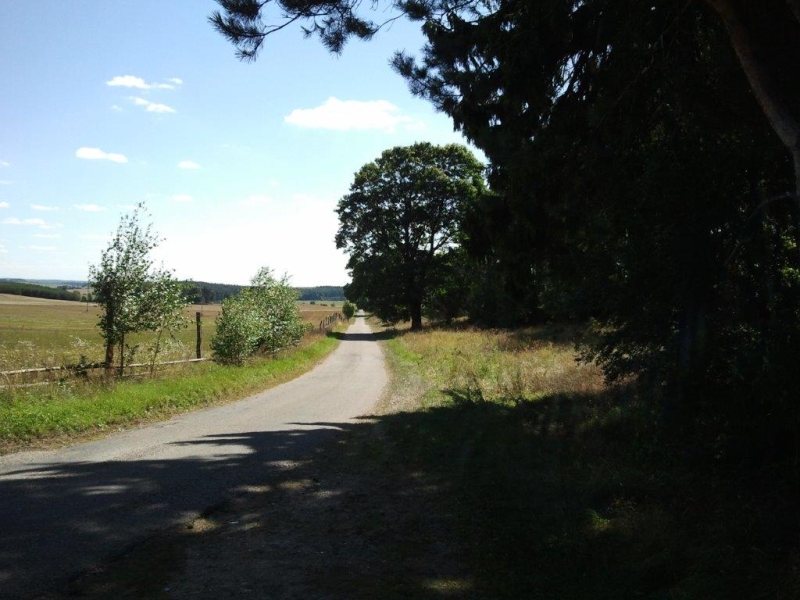
57.1 km - Via the crossing of field ways, the trail goes straight to the peak of hill (57.4 km) which offers a magnificent view of SZCZECINEK and TRZESIEKA. 60.1 km - In the village of TRZESIEKA, situated on the western shore of TRZESIECKO Lake, the bike trail reaches the SZCZECINEK-to-BARWICE highroad opposite a wooden cross, and turns left eastward. At the cross, the red „THE LAKES OF SZCZECINEK” trail meets other bike trails: the black „NIZICA” and green „VALLEY OF PARSETA RIVER” bike trails, and go together to the finish at the Comprehensive Secondary School in SZCZECINEK.
The green „VALLEY OF PARSETA RIVER” bike trail leads to the opposite direction.
60.6 km - At the western end of TRZESIECKO Lake, the red, black and green trails join the blue „AROUND TRZESIECKO LANE” bike trail . 61.0 km - The red bike trail, leading along the northern shore of TRZESIECKO Lake to the outskirts of LASEK ZACHODNI [WESTERN GROVE], the red trail leaves the village of TRZESIEKA, crossing the borders of the town of SZCZECINEK. 61.2 km - At the unguarded bathing beach at the base of the bay of TRZESIECKO Lake, the bike trail runs away from the road and leads along the path along the shoreline. 62.0 km - At the height of the second headland, to the left up the hill, a narrow path leading along the bunker 100 m away in the belt of the fortifications called THE POMMERNSTELLUNG branches off. Other 9 bunkers are located to the north. 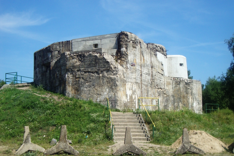
62.2 km - Continuing the ride along the shoreline path through the municipal park spanning along the lake waters, you reach the campsite and bathing beach on the headland overgrown with birches. 62.8 km - At the next unguarded bathing beach called „KOLKI”, the bike trail leads along a lime trail to the next bathing beach at the level of KILINSKIEGO Street. 64.2 km - At the height of JEZIORNA Street, you go past a marina and, together with another yellow „MAGICAL LANDSCAPES” bike trail , you reach LABEDZIA Street connected with land by a small wooden bridge. 64.7 km - A row of astonishing oaks and ashes marks the riding path to another marina with a wooden hangar on the water. 65.1 km - You reach Ks. ELZBIETY Street and end your excursion at the finishing point on the TRZESIECKO Lake.
THE VALLEY OF PARSETA RIVER SZCZECINEK
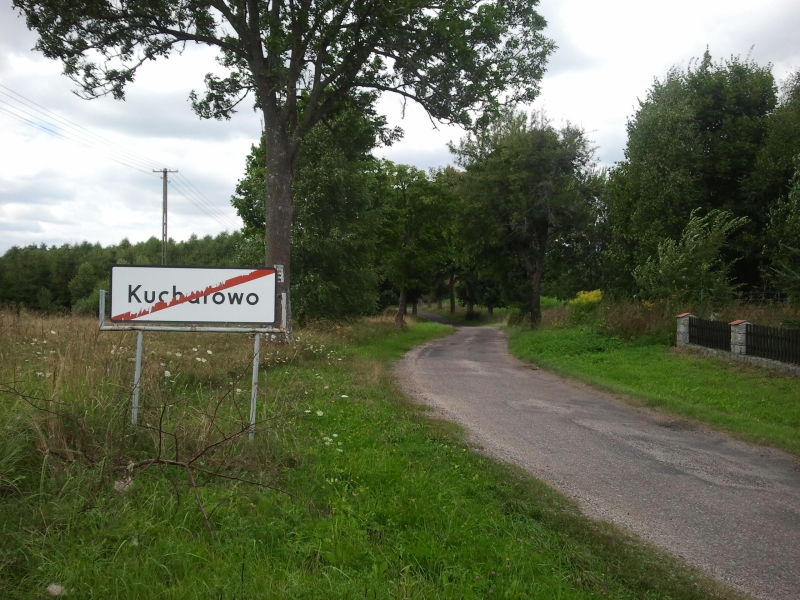
• TRZESIEKA • PARSECKO • RADOMYSL • NOWY CHWALIM • CHWALIMKI • JEZIORKI • JUCHOWO • KADZIELNIA • KUCHAROWO • MOSINA • SZCZECINEK Trail length - 51.1 km Green-coded The green „THE VALLEY OF PARSETA RIVER” bike trail follows the edge of a fabulous postglacial valley of the PARSETA River starting from the bottom of a now non-existent lake in PARSECK. Along the way, it reaches an old church of historical value and an old mansion house in PARSECK, CZARNE Lake hidden in the woods and a stage of fall, a remnant of a mill, behind RADOMYS. Having crossed the river, it goes up the edge of the opposite slope along an extended 3-kilometer uphill road. Here, you can relish an extensive view of the northeastern slope of the valley with POLSKA GÓRA hill (203 m above sea level). Magnificent lime, maple and sycamore lane lead along a large and extremely interesting palace and park complexes in CHWALIMKI and JUCHOWO.
[ckeditor_pg_embed:1577]
In JUCHOWO, you attention can be drawn to a towering silhouette of a neo-Gothic church situated on the lakeshore hill. Between KADZIELNIA and KUCHAROWO, the bike trail makes its way through the valley of NIZICA River and climbs over the hillocks of the terminal moraine.
0.0 km - The green „THE VALLEY OF PARSETA RIVER” bike trails starts in the junction at the Comprehensive Secondary School where Ks. ELZBIETY Street meets with TRZESIECKO Lake.
It follows the lanes of an old municipal park northwestward along the shores of the lake. Other bike trails accompany it from the starting point: the yellow “MAGICAL LANDSCAPES” trail, the red “LAKES OF SZCZECINEK” trail, the black “NIZICA” trail and the blue “AROUND TRZESIECKO LAKE” trail, but they run in the opposite direction. Just after you start the excursion, behind the fence of the Comprehensive Secondary School, you will spot the monument of JAN SAMUEL KAULFUSS, which commemorates one of the most eminent headmasters of the school who died in 1832. 0.2 km - You go past the marina and, surrounded by large alders, oaks and ashes, reach LABEDZIA WYSPA (SWAN ISLE), connected with the shore by a wooden bridge. 0.6 km - You leave the yellow bike trail. 0.8 km - Another marina behind the island. 1.0 km - At the level of J. LELEWELA Street, the trail continues along a 1.1-kilometer trail leading next to an unguarded bathing beach. 1.8 km - You cross the watercourse flowing to the lake and go past (2.1 km) another unguarded bathing beach called „Kolki”.
[ckeditor_pg_embed:1571]
2.3 km - Behind „Kwadrat” football pitch at T. KOSCIUSZKI Street, there is St Rosalia’s Chapel erected in the 1980’s (2.4 km), and behind it, you will spot the Church of OUR LADY OF OSTRA BRAMA built from granite boulders at the end of the 1980’s and at the beginning of the 1990’s. There is a Calvary at the Church. 2.8 km - You will encounter a campsite with accessible bathing spots at the headland of TRZESIECKO Lake, overgrown with birches. 3.1 km - At the height of another headland with good access to water, you make your way through the fortifications of the so called POMMERNSTELLUNG, a line of fortifications built by Germans before World War II. A number of bunkers spread to the north. 3.5 km - Lakeshore path leads through yet another headland.
3.9 km - Behind the lake bay, at the unguarded bathing beach, you enter the SZCZECINEK-to-BARWICE highroad. The trail turns left to the west towards the TRZESIEKA. 4.1 km - Behind LASEK ZACHODNI on the northwestern shore of TRZESIECKO Lake, you will spot the first buildings in the village of TRZESIEKA. 4.5 km - Towards the end of TRZESIECKO Lake, you leave the left-turning blue „AROUND TRZESIECKO LAKE” bike trail . 4.9 km - At a wooden cross, at the crossroads, you leave two bike trails: the black „NIZICA” and the red „THE LAKES OF SZCZECINEK” bike trails. The green „VALLEY OF PARSETA RIVER” bike trail proceeds alone westwards. 5.3 km - In front of a little chapel built from fieldstones with a statue of THE HOLY MOTHER OF GOD, the green bike trail turns into a dirt road northwestwards towards PARSECKO. From the tops of other, higher and higher hills scattered among fields, you will have a wonderful and extensive view in the southwestern direction.
7.9 km - From the sandy hillock, you rush down to the village of PARSECKO, spanning on the northeastern slope of the basin, once full of lakes, and now the seepage spring area of the PARSETA River. The length of the PARSETA River, which flows through a deeper and deeper picturesque valley, from PARSECKO to the estuary in the BALTIC SEA in KOLOBRZEG, is156 km. The village, mentioned in source materials as early as in the 13th century. From the 9th to the 12th century, it was a settlement on a now non-existent island built on five thousand oak piles. Among peasants’ houses on the outskirts of the lakeland niche, you can admire a parish neo-Romanesque Church of Our Lady of the Rosary dating back to 1926. Outside, it is made of brick and plastered, and inside it boasts a wooden semi-circled ceiling and choir gallery supported on four wooden pillars. From the western side, in front of the church, there is a wooden belfry with a bell dating back to 1901. 9.4 km - You leave PARSECKO through a lime lane leading towards RADOMYSL and submerge into the surrounding hilly landscape. On the west, you will be accompanied by a wider and wider, and deeper and deeper, irregular valley of the PARSETA River.
9.8 km - The lane is first surrounded by limes and later by maples and sycamores. Before you completely immerse in the multitude of hillocks, on the western side, you encounter a stony road branching off from the lane. You go down to the bottom of a postglacial valley. On the right, at the outskirts of meadows, you are welcomed by a huge oak. You enter PARSECKO 1. Straight in front of you, on a deep and very narrow escarpment, in this place of the valley of the PARSETA River, overgrown with towering beeches, oaks and ashes, you can see a neoclassicist 19th-century mansion house. In front of the mansion house, there are quite a few limes and a row of hornbeams. The row of hornbeams also borders and limits the park on the other side of the mansion house, where also two old oaks grow; one of them boasts a trunk with the perimeter of 3.55 m. 10.8 km - You come back to the trail and the asphalt road enters the forest. 11.2 km - From a tree-clad hillock, to the left of the trail, you have a wonderful view of the valley of the PARSETA River.
12.1 km - Several meters to the right, you can visit the shores of CZARNE Lake (area: 3.7 ha) situated in a pine forest, which offers bathing opportunities. You flash by the pine forest and, dazed by the scents of essential oils (13.5 km) you come into the arms of a lime trail reaching as far as RADOMYSL. From the village of RADOMYŚL surrounded with forests on three sides, you go northwestward 14.6 km - Just behind the village, there starts a long, exciting 1000-meter downhill ride through a lime and further maple and sycamore alley into a deep valley of the PARSETA River.
15.6 km - You cross the river with considerable speed. To the left, you encounter a stony road leading to a stage of fall and the remains of the mill 200 m away from the lane. In the shade of maples and sycamores you slowly move away from the meandering PARSETA River. Now, you have to go up the hill for 500 m and then rush down to the fork of roads in the forest. 17.3 km - Now you need to direct to the southwest, turn left towards NOWY CHWALIM. You have to show a lot of physical strength now, as here you begin a 3-kilometer uphill ride to the southwestern picturesque postglacial slope of the PARSETA River. You leave the forest. 19.0 km - Cycling among fields surrounded by ashes, with single chestnuts, you enter the village of NOWY CHWALIM.
19.1 km - Turn left at the fork of asphalt roads, at a stork’s nest on the power lines pole. While working your way up the hill among the buildings of NOWY CHWALIM, spanning along the southwestern slope of a postglacial valley, you can admire a superb view of an extensive depression. On the opposite northeastern slope, a distant range of terminal moraine prevails over the area with the highest peak in the vicinity - POLSKA GÓRA (203 m above sea level). The bottom of the valley of the PARSETA River, at the level of NOWY CHWALIM, lies at the height of ca. 105-110 m above sea level.
19.9 km - You approach the fork of the roads, at a wooden cross, near an old wooden house. For the last time, an exceptionally beautiful landscape mesmerizes you. Turn right to the southwest. Accompanied by sky-scraping ashes and chestnuts, as well as maples, you slowly finish (20.5 km) the very long uphill ride. The valley of PARSETA River is now over.
21.2 km - You approach the crossroads of asphalt roads. On your left, there is a road to the Peat Production Plan in NOWY CHWALIM, where peat for the agricultural and horticulture production is obtained from CHWALIMSKIE BAGNO (CHWALIM MARSHES). On your right, you will see the road to STARY CHWALIM running through the picturesque landscape of dispersed building of KNYK settlement. Here, the trail meets the red „HILLS OVER THE PARSETA RIVER” bike trail which starts and end in BARWICE. The green „THE VALLEY OF PARSETA RIVER” bike trail runs straight on. 21.9 km - You enter the moss-covered tunnel of an old lime lane which can tell you a lot of stories from the past.
23.3 km - Now you ride into an extremely mysterious place at the outskirts of the village of CHWALIMKI. On the right, you will spot a large palace park; to the left there is an oak alley which surrounds the rectangular village pitch. The park adjoins a well-preserved palace and grange complex. A wooden gate in a brick tower topped with an air drain leads to the inner courtyard. In the southern part of the grange, a multi-storey stylish granary dating back to 1924 with wooden grain containers may be of interest. Deeper inside the courtyard, behind a forged metal gate, there is a palace erected in the first half of the 19th century. The palace is surrounded by firs, limes, maples and an extraordinary beech with the perimeter of 3.15 m, with a grafted branch with strangely-shaped leaves. Also, a huge white poplar with the perimeter of 5.30 m, enveloped with impressive ivy with winter-hard leaves overwhelming the huge branches attracts attention. To the north of the palace, the entry to the mysterious beautiful park is guarded by two enormous oaks with trunks perimeters of 3.55 m and 3.50 m, and a big larch 3.18 m in perimeter. At the edge, the pond lies in the shade of a colossal oak with a trunk perimeter of 4.85 m. In the middle of the forest shrine, among the columns of several tens of ancient beeches and oaks, a small ZEGNICA River, the PARSETA River tributary, meanders across the woods. A mysterious, unfathomable 10-lime ring sleeps behind the stream on the hill. Hornbeams mark the borders of the park. Returning to the bike trail along the southern wall of the grange, you go past a row of 12 old oaks next to the granary. You leave the red bike trail.
23.5 km - You re-enter the lime lane and leave CHWALIMKI. 25.4 km - Through a small forest, you approach the crossroads with the SZCZECINEK-to-BARWICE highroad and head straight on. In the shade of an old lime lane, you make it through the hilly landscape to the village of JEZIORKI. 26.7 km - Just ahead of the village, a field way leads you left to a huge erratic boulder situated among meadows 800 m northeast of the village of JEZIORKI. The bike trail runs through the village of JEZIORKI and(28.1 km) reaches the edge of the forest through the road, first surrounded by oaks and later by ashes.
28.8 km - In the forest, at the fork of asphalt roads, at a granite boulder, the green bike trail runs straight southward towards the village of JUCHOWO. The road to RADACZ on your left. 29.0 km - You leave the forest behind and, protected by maples and sycamores trees in the next lane, go down for about 1,200 meters straight to the village of JUCHOWO. 29.3 km - At the level of the hills covered with beeches, you will have a wonderful extensive view of southwestern landscapes. 30.1 km - To the right in the field, about 100 m away from the trail, there is a building of an old church, now used as a warehouse. 30.2 km - You enter the village of JUCHOWO on JUCHOWO Lake (area: 32 ha; depth: 4.5 m; 143.2 m above sea level). In the distance, a sky-scraping silhouette of the church situated on the opposite shore of the lake cannot be missed.
30.6 km - At the fork of asphalt roads, at the edge of the palace park, the bike trail turns left eastwards. It meets the red „To Ciemino Lake” bike trail which starts and ends in BORNE SULINOWO. You cannot miss the attractions the village offers. JUCHOWO was established in 1570 by Aleksander and Asmus Kleist. A document of 1575 mentions the name JUCHOW. In 1868, the later owners of this estate – the Dennig family – erected a magnificent eclectic-style palace on the eastern lake shore, next to a very interesting 17th-century park. Today, the palace is a pathetic view, falling into ruin. In the vast palace park, in a small valley, there is creek taking up the excess of water from the JUCHOWO Lake to the NIZICA River. Among the park trees you can see beautiful oaks, beeches, ashes, maples, as well as limes, hornbeams, larches and chestnuts. There is a very attention-grabbing chestnut tree with six trunks. In 1897, next to the palace, on the hill near the lake, St Anthony’s Church made of red brick was built in neo-Gothic style. The church has a tower added on its western wall, topped with several-meters-long spire with an inscription. Daylight passing through six high, ogival windows and a colorful stained-glass window in the chancel presenting Adoration of the Christ-Child illuminates the dark interior. It reveals the interior with a wooden beam ceiling, sandstone pulpit dating back to 1896 and a throne-shaped confessional.
30.9 km – You leave JUCHOWO going through a lane of maple and sycamore trees running eastwards to KĄDZIELNIA village. The asphalt road cuts right through rocking and hilly landscape. Secluded clumps of trees on hilltops add to the area's picturesque character. 33.5 km – The alley of maples and sycamores ends on the outskirts of a small village – KADZIELNIA – located on the western slope of the valley of the NIZICA River. 33.8 km – You enter the concrete bridge connecting both banks of the water course. Right next to the bridge on the NIZICA River, a green “THE VALLEY OF THE PARSETA RIVER” bike trail joins the black “NIZICA” bike trail. You start a long uphill ride to the long range of terminal moraine height, covered with a coniferous forest. 34.7 km – You reach the top of the height and begin a long downhill ride.
35.1 km – On the right, above the pine tree tops, you can spot a wooden vantage point (tower), visible from approx. 20 km. 35.7 km – You drive in the KUCHAROWO village, lying among meadows and fields. You leave the red “TO THE CIEMINO LAKE” bike trail. 35.9 km – You pass by the KUCHAROWO forest services facilities and leave the village.
 36.1 km – The narrow asphalt road lined up by ashes leads us from KUCHAROWO towards MOSINA village. To the south on the ridge of a vast terrain elevation rests a windswept and enchanting settlement – GRZYWNIK. Beyond the GRZYWNIK height you can see the glistening waters of a fairylike CIEMINO Lake. 38.0 km – You dash through the ash alley past "AGRO-MEAT" Agricultural Company and reach the buildings of a large village of MOSINA. 38.7 km - To the northwest of the village there is BAGNO WIELKIE (GREAT SWAMP), an area of vast meadows and peat bogs, the land of evening mists. 39.4 km – At the fork of asphalt roads, by the roadside metal cross in MOSINA, the “THE VALLEY OF THE PARSETA RIVER” green bike trail turns right to the southeast, splitting from the black “NIZICA” bike trail. 40.9 km – Among the infinite area of meadows and fields the bike trail reaches a few farms in MOSINA settlement. Behind the settlement, going past the old oaks, you ride quite long uphill to the forest stretching as far as to SZCZECINEK. 42.4 km – You turn left into the second forest road with cinder surface, leading northeastwards towards SWIATKI village. The “THE VALLEY OF THE PARSETA RIVER” green bike trail meets here with the black “NIZICA” bike trail leading in the opposite direction.
42.5 km – You ride uphill onto the ridge of the height and go downhill. On the right, the dense forest covers bunkers – elements of so called POMMERNSTELLUNG fortifications, built by Germans before World War II. 43.0 km – You dash past a bunker situated to the right of the road. Here you cross the fortifications of the POMMERNSTELLUNG. Other fortifications can be found along the trail on the left-hand side, towards WILCZKOWO Lake.
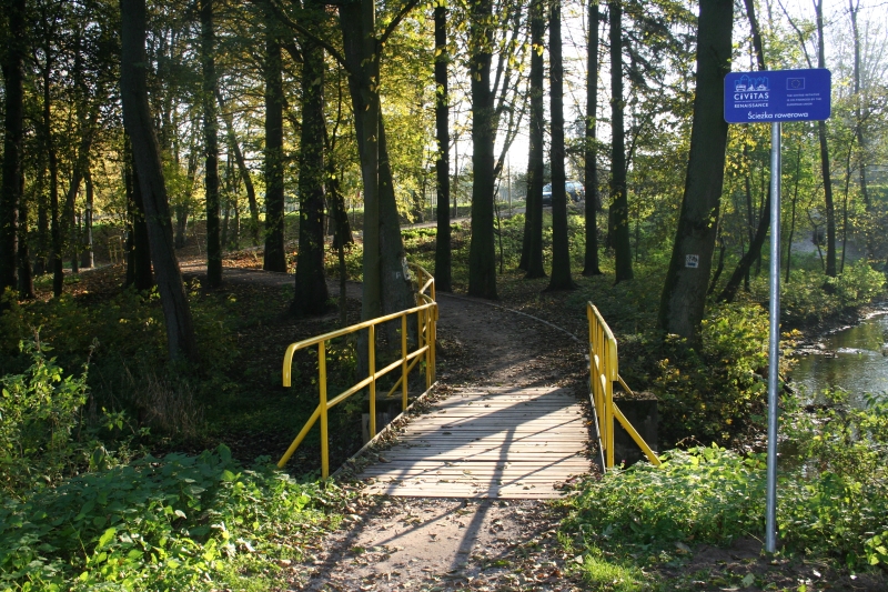
44.9 km – Ahead of you, there is the third forest vale, on the bottom of which a creek flows to WILCZKOWO Lake. Green and black bike trails join the yellow bike trail called "MAGICAL LANDSCAPES", turning right into a cinder road leading to SITNO. 45.0 km – To the left of the stream, there is the forest and floristic reserve area “DEBY WILCZKOWSKIE” [“WILCZKOWO OAKS”] with the area of 1.62 ha, established in 1974. Protection is provided for 150-year-old oaks, with a growing place of a rare plant – Gagea spathacea. 45.4 km – At the edge of the reserve, next to the trail there is an ancient lime-tree, now lawfully protected under the environmental law. 46.0 km – A stony road leads you out of the forest. 46.5 km – In no time you will enter the village of SWIATKI. Road pavement changes to asphalt. 47.0 km – A cinder road turns left right in front of the pond, leading towards the nearby start of the nature path called “LAS KLASZTORNY” ["MONASTIC FOREST”], which is 3.9-kilometer long. Lots of unforgettable experiences await the tourists in a beautiful beech forest, among the hills and between TRZESIECKO Lake and WILCZKOWO Lake.
47.1 km – Dashing through SWIĄTKI you go past the Stanislaw Staszic Agricultural School Complex. 47.4 km – Behind the center, on the high shore of TRZESIECKO Lake, there is a little manor house with no particular style. [ckeditor_pg_embed:1560]
47.7 km – Ahead of LIPOWY POTOK stream flowing from LIPNO Lake to TRZESIECKO Lake, you ride on the sidewalk and take a dirt path to the bottom of a deep postglacial channel filled with lake waters. To the south there is the mysterious MARIENTRON hill (153 m above sea level). In 1356, Pomeranian dukes BOGUSLAW V, BARNIM IV and WARCISLAW V founded here an Augustinian monastery called MARIENTRON or MARIA CELL. The monastery and the church were built of timber and stone. In 1361, Duchess ELIZABETH, a daughter of King KAZIMIERZ III THE GREAT and wife of BOGUSLAW V, died here. Toward the end of the 15th century the monastery fell into ruin and was pulled down. 47.8 km – You take the footbridge at the mouth of the LIPOWY POTOK stream to TRZESIECKO Lake. Here, the “THE VALLEY OF THE PARSETA RIVER” green bike trail meets the “AROUND TRZESIECKO LAKE” blue bike trail. The last section of the green bike trail leads through a path on the bank, along a meandering eastern shoreline of TRZESIECKO Lake.
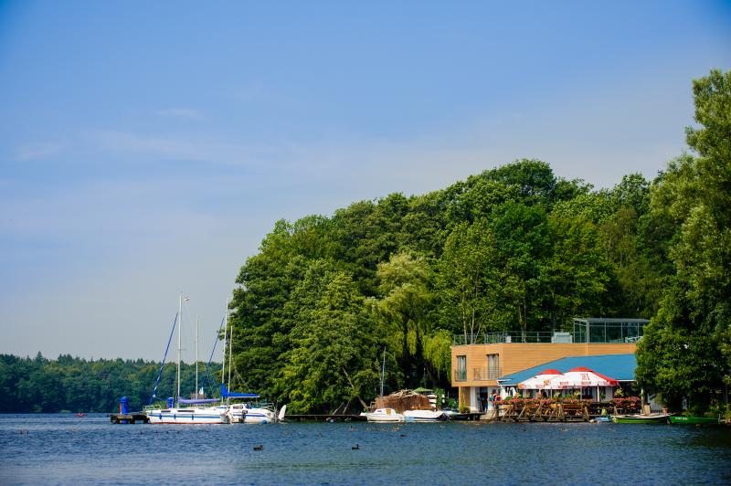
48.9 km – You get to an unguarded bathing beach at the foot of a large peninsula. 49.1 km – Moving through a park lane, you can spot an observation tower on the hilltop built in 1910 of carved stones. You ride around the lake bay with ŚLUSARSKA ISLAND and through a cinder public park lane past an indoor swimming pool, “ŚLUSARNIA” sports arena and complex of the Sports and Recreation Center facilities.
50.1 km – Five huge oaks next to the newly-built, state-of-the-art football pitch. 50.5 km – You approach the municipal beach with padding, sailing and swimming equipment rental service. 50.7 km – Through the ash lane, you reach a wooden pier from which “DANUSIA II” pleasure boat departs. 50.8 km – On the other bank of the NIEZDOBNA (NIZICA) River flowing out from TRZESIECKO Lake, you can delight in the Castle of the Pomeranian Dukes. The southern wing dates back to the 14th century. Rebuilt in the early 17th century, for a few decades it served as a legacy for widowed wives of deceased dukes.
 50.9 km – The bike trail goes further on through the concrete bridge on the NIEZDOBNA River. From this place, you can see the building of the musical school dating back to1902 and a neo-Gothic Church of the Birth of the Holy Virgin built in the years1905-1908 with its 78-meter tower. You take a turn to the right over the bridge, then left, riding through a park square with a fountain. 51.0 km – By the next square with a fountain there is a concert bowl, and a marina at the lakeshore. 51.1 km – The “THE VALLEY OF THE PARSETA RIVER” green bike trail reaches the junction of bike trails at the Comprehensive Secondary School, on TRZESIECKO lakeshore.
MAGICAL LANDSCAPES SZCZECINEK
• SZCZECINEK-ŚWIĄTKI • SITNO • DZIKI • TUROWO • WILCZE LASKI • KRUSZKA • LOTYN • DRZEWICE • WOJNOWO • DRAWIEŃ • ŻÓŁTNICA • BUCZEK • CZARNOBÓR • SZCZECINEK Trail length – 51.7 km Yellow-coded The “MAGICAL LANDSCAPES” bike trail goes through a picturesque LAND OF THREE VALLEYS and slightly hilly area of ground moraine spreading beyond it, up to the deep postglacial valley of the GWDA River. Maple and sycamore, lime-tree and ash lanes lead through villages scattered among fields and meadows, and secluded farms hidden between them. The trail is marked by wayside crosses and shrines, neo-Gothic and half-timbered churches, palaces and parks as well as half-timbered farm buildings.
0.0 km – The trip along the “MAGICAL LANDSCAPES” yellow bike trail starts at the junction, where Ks. ELZBIETY Street approaches TRZESIECKO Lake, next to the building of the Ks. ELZBIETA Comprehensive Secondary School erected in 1914. You wend your way south-eastwards through the park alley, along other bike trails – blue and black, and the green one leading in the opposite direction. You go past the fountain situated at the middle of the square and the concert bowl. On the right, the marina is fading away behind the trees and the Castle of the Pomeranian Dukes emerges.
0.1 km – The oldest part of the castle, earlier erected on a lakeshore island of TRZESIECKO Lake is the southern wing dating back to the 14th century. Rebuilt in the early 17th century, for a few decades it served as a legacy of the widowed wives of deceased dukes. When you reach the second fountain over the dense tree crowns you can spot a tall 78-meter tower of the neo-Gothic church built in the years 1905-1908. The Church of the Birth of Holy Virgin is equipped partly with fittings transferred from the old St Nicholas’ Church, such as a limestone epitaph of Dorota A. Westreglen – wife of the Szczecinek starost - dating back to 1621 and six brass chandeliers dating back to the 1st half of the 17th century. In the chancel, you can relish four neo-Gothic stained glass windows with eight scenes from the life of Jesus Christ and a neo-Gothic main winged altarpiece. At the organ gallery, you can see large organs with 1670 pipes.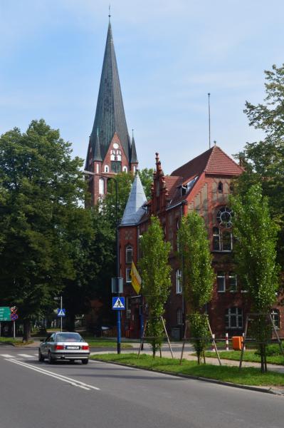
0.2 km – From the concrete bridge on the NIEZDOBNA River you can spot the musical school building from 1902 standing in front of the church. 0.3 km – At the mouth of the NIEZDOBNA River from TRZESIECKO Lake, you can catch sight of the southern castle wing. The bike trail leads through a park lane along the lakeshore. 0.4 km – From the wooden pier from which “Jadwiga” pleasure boat departs, an ash alley leads to the municipal beach with sailing, paddling and swimming equipment rental service. 0.6 km - 0.9 km – Next to the new football pitch built in 1998, you go past five oaks of enormous sizes.
1.5 km – Riding past the fence of the Sports and Recreation Center you get to the foot of the peninsula with “SLUSARNIA” sports arena. You go past an indoor swimming pool and ride around a large lake bay with the “SLUSARSKA” island. 2.0 km – You reach the foot of the hill with an observation tower made of rectangular granite blocks and brick in 1910. 2.2 km – At the foot of the large peninsula you ride past the unguarded bathing beach. Lakeshore path leads to the southern end of TRZESIECKO Lake, were LIPOWY POTOK stream flowing from LIPNO Lake runs into it. 3.3 km – From the footbridge on the LIPOWY POTOK stream you see the mysterious MARIENTRON hill rising 19 meters above the lake water level. In 1356, Pomeranian dukes BOGUSLAW V, BARNIM IV and WARCISLAW V founded here an Augustinian monastery called MARIENTRON or MARIA CELL. The monastery and the church were built of wood and stone. In 1361, Duchess ELIZABETH, a daughter of King KAZIMIERZ III THE GREAT and wife of BOGUSLAW V, died here. Toward the end of the 15th century, the monastery fell into ruin and was pulled down.
 Over the footbridge on LIPOWY POTOK stream, the “MAGICAL LANDSCAPES” yellow bike trail departs from the “AROUND TRZESIECKO LAKE” blue bike trail. Along the black and green bike trails, it leaves the deep TRZESIECKO Lake valley into SZCZECINSKA Street.
3.4 km - Encircling the hill on the southeastern and southwestern side, it climbs up a steep drive uphill to the ŚWIATKI. 4.0 km – You go past the buildings and sports facilities of the Stanislaw Staszic Agricultural Schools Complex. 4.2 km – To the right, northwestwards, a cinder road turns right, leading to the nearby start of the nature path called "MONASTIC FOREST”,3.9-kilometer long.
4.6 km – The yellow bike trail leaves SWIATKI leading through fields to the southwestern direction. Road surface changes from asphalt to stones, and then cinder. 5.2 km – Among ancient oaks, you drive into a mixed forest. 5.8 km – Here you can notice a moss-overgrown forest “warden” – an ancient lime-tree, now a nature monument. It guards the entry to the forest and floristic reserve area “WILCZKOWO OAKS” with the area of 1.62 ha , established in 1974. Protection is provided for 150-year-old oaks, with a growing place of a rare plant – Gagea spathacea.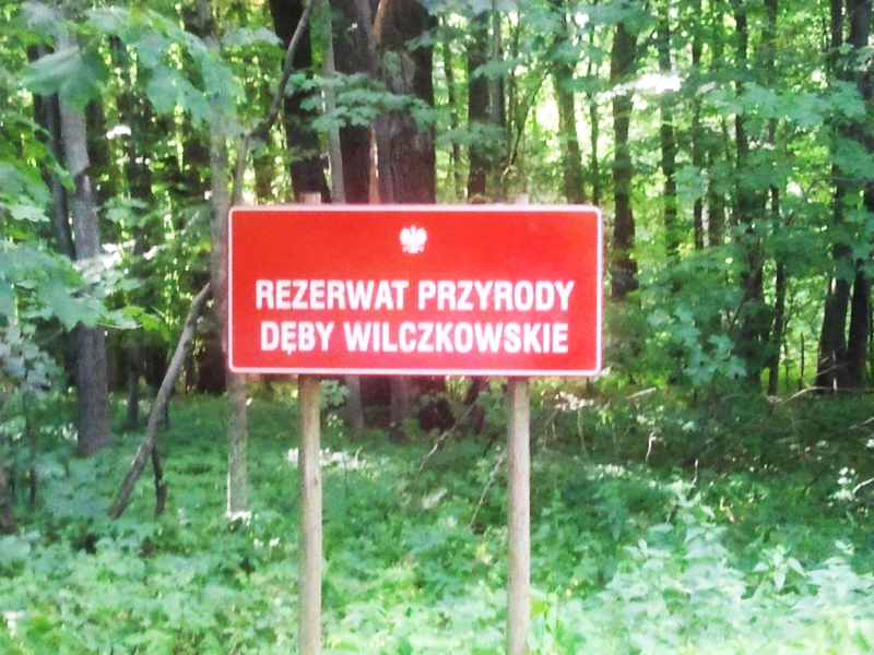
6.2 km – At the edge of the reserve, you drive down into a valley of a small creek flowing to WILCZKOWO Lake. 6.2 km – Over the creek the “MAGICAL LANDSCAPES” bike trail turns left to the southwest, splitting from black and green bike trails running through the main forest road. 6.6 km – Soon, it also leaves the forest, goes over the railroad and leads through a slightly hilly terrain to the village of SITNO looming in the distance. 7.1 km - 8.2 km – SITNO village is located on a gently falling slope of a postglacial elevation behind which there are two exceptionally pretty RYBNO and ROKITNO ponds.
8.4 km – You reach the main highroad and turn right, then after 100 meters take a turn left into a narrow asphalt road leading to the village of DZIKI. 8.7 km – You dash past the neo-Gothic red-brick Church of the Sacred Heart of Jesus, erected between 1870 and 1880. 8.8 km – Surrounded by magnificent maple and sycamore trees, you leave SITNO and climb uphill to the top of the hillock offering an uniquely beautiful view of two postglacial lakes: RYBNO (142.4 m above sea level; area of 10 ha) and ROKITNO (143.2 m above sea level; area of 9.5 ha).
9.0 km – They fill the middle valley of the LAND OF THREE VALLEYS. The other two valleys contain: TRZESIECKO Lake; a nameless small pond and LIPNO Lake, connected with the LIPOWY POTOK stream, and KOPIEL Lake; a nameless small pond; DZICZE, RYMIERZEWO, PRZELEG and KNIEWO lakes connected by the PLYTNICA River. 10.8 km – You get to the opposite eastern slope of the valley where you can take pleasure in the landscape with glistening KOPIEL Lake waters (141.4 m above sea level; area: 14.6 ha; depth: 3.4 m).
12 km – The asphalt road lined up with maples and sycamore trees approaches DZICZE Lake (141.6 m above sea level; area of 14.5 ha; 2.8 m deep) located at the foot of DZIKI village. The PLYTNICA River flows through DZICZE Lake, connecting the long and narrow postglacial channel of the following lakes: RYMIERZEWO, PRZEŁĘG and KNIEWO. They form an interesting canoeing trail.
15.3 km At the fork in the road, at a roadside shrine, next to the railway station in Turowo, head to the right to wolf hazelnuts. However, it is to get to the turn-based, where the elevation is the neo-Gothic church St. Joseph from 1879 and lies near the pond neo-Gothic castle from 1896. (16.3) miles Topolowa avenue we move away from the village in turns. We pass the village SPOTKANIE (MEETING).
19.7 km In the village Wilcze Laski, at the junction of roads, stands the neo-Gothic church All Saints in 1894. To the right, the road deviates to the ruins of the neo-Gothic palace of the second half. Nineteenth century, with the remainder naturalistic park. Going further you can find in front of the wall of the forest closed the airport. Yellow bike trail turns left at the church, east to LOTYŃ. Ribbon linden, maple and then Jaworowa Avenue Sneak through the patchwork of fields, between solitary colonies.
25.7 km The temple, at the fork of asphalt roads, ranging manor park with many interesting trees: oaks, beeches, sycamores, spruce, hornbeam and linden trees. The yellow trail bike LOTYŃ directed to the north-east. toward DRAWIEŃ.
29.4 km Landscape of fields resplendent whitewashed walls of buildings scattered rural village Wojnowo. They point out the characteristic motifs framed and roofed with red tiles. (30.1 km) From the chapel in Wojnowo - Built on Birch and Ash Avenue heading to the edge of the river Gwda glacial valleys.
32.3 km) Yellow Bike Trail "Magic LANDSCAPES" falls rapidly down the slope to the village DRAWIEŃ glacial valleys. (33.2 km) Church in Drawieniu along przypałacowego park, with partly preserved neo-gothic chapel - mausoleum, we reach the half-timbered church M. B. Rosary 1695.
36.4 km) Among households ŻÓŁTNICA attention is drawn to the village board walls bolt church M. B. Czestochowa in 1821, in a free-standing wooden bell tower is equipped with two bells. One of them, the bronze, the Gothic of 1556 years, is the oldest in the area. ŻÓŁTNICĘ leave towards the north-west., Toward spines.
39.6 km The settlement BUCZEK immerse ourselves in mixed CZARNOBORSKI LAS. Break through the border town spines.
42.8 km On the banks of Lake FOREST (143.8 m above sea level, pow. 16.67 ha) located Forestry Czarnobór pass. 42.9 km The wooden wayside cross, next to the campsite Forestry Czarnobór, turn left along the lake shore from an unguarded swimming.(43.2 km) Lakeside slope covered with two old oaks - monuments.
43.6 km The last buildings ribbon ends asphalt road and stops the forest wall. Dirt road leads through the hills, next to the brick substation, two lonely farms, to travel on the railway line SZCZECINEK - CHOJNICE. The terrain elevations extensive views over the city SZCZECINEK.
46.5 km) At the second level crossing on the line SZCZECINEK - MIASTKO, going to the left, towards the west. (47.8 km) At a level crossing on the railway line SZCZECINEK - KOŁOBRZEG, get onto the highway SZCZECINEK - GWDA in the street Fisheries. We cross the road between the sewage treatment plant, and gardens workers.
49.1 km The level crossing on the line SZCZECINEK - thundering, we continue to travel down the street water supply. (49.6 km) Museum of Napoleonic soldiers pass by HILL barn (St. George) with tap water tower.
49.7 km The congregation of the Evangelical - Lutheran the mortuary chapel of the early twentieth century, now the church of the Evangelical - Lutheran, turn right down the street. Botany. (50.7 km) Streets: Botany and Green, we arrive at the intersection of ul. Koszalin. Along with the red trail bike "Szczecineckie LAKE" follow Jeziorna street to the shoreline of Lake Trzesiecko.
 51.0 km from the coastal restaurant "JOLKA" going to the city park alleys node. We pass ISLAND swans connected to the mainland by a wooden bridge and harbor water.
51.7 km Finish the journey along the yellow trail "Magic LANDSCAPES".

