 10°C
10°C


LOCATION OF THE CANOEING TRAILS
The GWDA River, which flows from STUDNICA Lake, has its source in the central part of Pomerania on the watershed, in the range of the uplifts of a terminal moraine. In the northwest, it borders the DRAWSKIE DISTRICT LAKE and in the northeast it reaches Szczecinek municipality. Along with is tributaries NIZICA and DOŁGA, the GWDA River forms a water system with canoeing trails “GWDA” and “PĘTLA SZCZECINIECKA” („SZCZECINEK LOOP”). In its upper reaches of the river, along with the DOŁGA River, it flows through an afforested, postglacial area of moraine hills, which are crossed by numerous lake valleys. This region, known as “JEZIORA SZCZECINIECKIE” (LAKES OF SZCZECINEK), forms a Protected Landscape Area which spans over 18.000 ha. The GWDA River passes the eastern part of Szczecinek municipality and flows through 4 lakes: STUDNICA, WIERZCHOWO, SMOLĘSKO and WIELIMIE. It enters a vast proglacial stream valley on the edge of outwash plains. The part of the GWDA River from STUDNICA Lake to the estuary of the DOŁGA River to it, also belongs to „SZCZECINEK LOOP” canoeing trail, which starts and finishes in TRZESIECKO Lake in Szczecinek. The trail runs through nine lakes and three rivers: NIZICA (NIEZDOBNA), GWDA and DOŁGA. Although somewhat difficult at times, as it requires transportation of canoes over land and going upstream, the trail is an unforgettable one. The original, magnificent and untainted richness of nature along with a constantly changing landscape, multiple lakes and variable river valleys contribute to the charm of these canoeing trails.
”GWDA” CANOEING TRAIL DRĘŻNO
 • STUDNICA LAKE • ORAWKA • WIERZCHOWO LAKE • STARE WIERZCHOWO • SMOLĘSKO LAKE • SPORE • WIELIMIE LAKE • GWDA WIELKA • JELENI RUCZAJ• GOŁĘBIEWO • LUBNICKI MŁYN
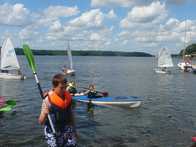
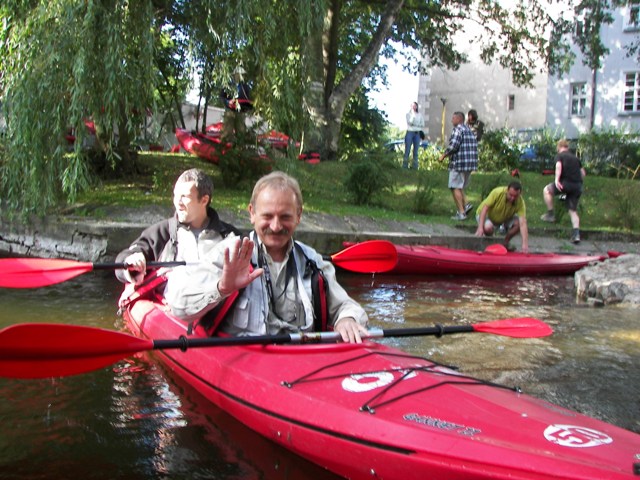
The GWDA River is 145 km long and it is a right tributary of the NOTEĆ River. It has its source in the range of the watershed of STUDNICA (DRĘŻNO) Lake, at the height of 139.4 m above sea level. In its southern course, it flows into the NOTEC River in UJSCIE, 46 m above sea level. Its basin area of 4943 square km is regarded to be the biggest one in WESTERN POMERANIA. The numerous tributaries of the GWDA River among them NIZICA, DOŁGA, CZERNICA, SZCZYRA, DEBRZYNKA, PŁYTNICA, RURZYCA, PIŁAWA and GŁOMIA are also interesting canoeing trails. It takes from 7 to 8 days to cover the whole trail. The guide describes the upper 45-kilometer part of the GWDA River which is almost entirely located in Szczecinek municipality. The starting point is situated on STUDNICA Lake and the finishing point is in LUBNICKI MLYN. It takes from 2 to 3 days to cover this trail. The section of the GWDA River, from STUDNICA Lake to DOŁGA in GWDA WIELKA village also forms a part of the „SZCZECINEK LOOP” trail. In the upper reaches of the river, between STUDNICA and WIELIMIE lakes, the GWDA River flows through the Protected Landscape Area called “THE LAKES OF SZCZECINEK”. Its waters are 1st river quality class. 145.0 km The best starting point of the GWDA trail is Stanica ZHP (Scout Hostel) in the village of DRĘŻNO situated on the shore of STUDNICA Lake (DRĘŻNO). There is an asphalt road from SZCZECINEK (26 km away) to DRĘŻNO via STARE WIERZCHOWO. You can also access DRĘŻNO from STĘPIEN, BIAŁY BÓR or POROST.
There is a grocery in the village. The scout hostel belongs to the Zdzislaw Pilawa Scout Troops Headquarters, 78-400 Szczecinek, ul. 9 Maja. They offer access to a campsite, holiday houses, canteen, showers and a bathing beach with a pier. From the hostel, the canoeing trail leads to the northwestern end of a trough-valley STUDNICA Lake (139.4 m above sea level; area: 101.7 ha; depth: 24.9 m; length: 2.1 km; max. width: 0.8 km). The “GWDA” and „SZCZECINEK LOOP” trails meet at STUDNICA Lake and run together. The shores in the central part of the lake are very high and they are covered with evergreen pine forests. 143.0 km O.W. ORAWKA Holiday Center is located on the left shore close to the outflow of the GWDA River from STUDNICA Lake, tel. ORAWKA (0-94) 375 77 94, tel. Koszalin (0-94) 345 14 74.
[ckeditor_pg_embed:1572]
The center offers holiday houses and swimming & paddling equipment. You continue your journey and go under a small concrete bridge in a holiday village of ORAWKA and then you go through a narrow passage between STUDNICA and WIERZCHOWO lakes. Just behind the bridge, on both banks of a shallow GWDA River, there are campsites belonging to Szczecinek Forest Services.
142.9 km A sandy-bed outflow leads you to the immense and formidable ground moraine lake: WIERZCHOWO (139.0 above sea level; area: 731 ha; depth: 26.5m; length: 5.2 km; max. width: 2.3 km). Then, you go south along the eastern shore and you pass by a single lake island. The lakes are home to vendaces and Baltic whitefish to mention but a few.
142.2 km The area just behind the island on the eastern shore is dominated by an afforested DRAWSKA GÓRA Hill (166.6 m above sea level). The hill is adjacent to a high and steep embankment of a well-preserved old settlement dating back to the 8th-9th century. Another campsite of Szczecinek Forest Services, “PIASKI”, is situated in the pine forest close to long sandy beaches at the southern foot of DRAWSKA GÓRA Hill. On the northwest shore of WIERZCHOWO Lake, and more specifically on its long peninsula, you can spot another old and well-preserved ring-type settlement. It was founded between the 9th and 11th century. It is one of the biggest settlements in the vicinity, surrounded by a high stronghold with three cracks. Going south along the eastern, locally sandy and high, shore of WIERZCHOWO Lake, you go past an immense beach and holiday houses hidden in the forest.
140.2 km The estuary of the GWDA River from WIERZCHOWO Lake is hidden behind a narrow belt of lakeshore reeds next to an immense bay in the southwestern part of the lake. The fast stream of the river takes you further; you pass by a few granite boulders and under the remains of a small concrete gate. On the left bank of the river, at the gate, you catch a glimpse of a forest clearing, a municipal campsite zone.
138.9 km The lazy stream of the GWDA River in its wide and regulated bed takes you to the village of STARE WIERZCHOWO. You paddle under a stone-brick bridge in the village, whose vault is shaped as a semicircle. Just before crossing the bridge, you can see a plain where you can have a rest. It is also a good starting point for your canoeing adventure. The grocery is on the left bank of the river ca. 100 m away. Another one is 300 m away, next to a church.  South of STARE WIERZCHOWO, the GWDA River flows straight and enters an immense forest area.
136.7 km The GWDA River flows among resinous pine forests, into SMOLESKO (SMAUSZ) forest lake (138.3 m above sea level; area: 60 ha; depth: 4m; length: 2.1 km; max. length 0.3 km). The lake covers the area between SMOLĘSKA GÓRA to the west and JAMIEŃSKIE GÓRY (Jamienskie Mountains) with its highest peak at 168 m above sea level in the east. In the eastern end you can relish water gardens of water lilies.
136.2 km A very good site for a short stop is to be found on the left bank of the GWDA River close to its estuary from SMOLĘSKO Lake. 200m to the east, you will find a forest clearing and a small holiday village of MALECHOWO. 136.1 km You go between three rows of wooden poles (the remains of an old wooden bridge) 100m from the estuary. Along the riverbanks, there are rows of alders and hazels which form a kind of shaded tunnel through the forest wilderness. Then the river curves westwards and it splashes against high slopes of JAMIEŃSKIE GÓRY (Jamienskie Mountains).
135.0 km You reach a small concrete bridge with a small gate. The current of the river gets faster and faster, the river bed is stony and there are some protruding boulders. Under the bridge there is a small stage of fall. If the level of water is low, very carefully let your canoe flow down with the stream. Behind the gate you can spot the edge of a forest and boggy meadows of MALECHOWOWSKIE BŁOTA (Malechowskie Marshes).
131.3 km On the edge of SPORE holiday village you paddle under a concrete road bridge. The above asphalt road leads to Szczecinek, 15 km away. Just behind the bridge, on the right bank, there is a good starting point for canoeing rallies. Two groceries and a mini-bar are 200m away in the center of the village. On the western bank of SPORE – a ribbon lake (137.9 m above sea level; area: 90 ha; depth: 7.4 m; length: 2.8 km; max. width: 0.5 km), you can find accommodation in OW “SPORE 51” Holiday Center which offers holiday homes, tel. 0-502 79 22 77, or in “Alex” agritourism farm, tel. (0-94) 372 72 67, SPORE 50
131.2 km On the left bank, 150 m away from the bridge, you can find a passage through a metal fencing. It is an entrance to a campsite of O.W.”Wodnik” Holiday Center, tel. (0-94) 372 73 00; 0-604 18 77 44. The holiday center offers amenities such as holiday homes, canteen, day-room and bathrooms. Behind the village you can delight in high, mild, afforested slopes of a valley. This is the starting point of the gorge of the upper course of the GWDA River.
130.3 km You reach a concrete road bridge which is a junction of fragments of stone-surfaced roads leading from SPORE and the crossroads at the level of DOBROGOSZCZ. Just behind the bridge the river speeds up and gets narrow. The huge masses of water splash against a concrete stage of fall and granite boulders near the foundations of an old water mill. Here you have to transport canoes for 25 m over the stage of fall on the right side of the bridge. If you want to pitch a tent here, transport canoes on the left side and go directly to a campsite near the forest. The area surrounding the bridge is another convenient point for starting or finishing canoeing trips. Behind the remnants of the mill, the river enters a coniferous forest. Diversified forms of occasionally high banks are overgrown with alders and poplars. Lumbered trunks of old trees make this trail even more out of the ordinary. The current of the river is quite fast and the bed is sandy.
129.6 km Now you have to make your way through among few boulders and stone bridgeheads of an old, no longer existing bridge. Next to the right bridgehead there are two enormous, sky-scraping spruces. Lumbered trunks of trees across the river enhance the attractiveness of this part of the trail. The current slows down. 128.8 km This is the end of the upper gorge of the GWDA River. The banks are lower and covered with marshy alders.
127.5 km The banks of the estuary of the GWDA River to a huge ground moraine WIELIMIE Lake are marshy and occupied by reeds. You paddle southeast along a reed-covered bank and past a small island with a clump of trees and reeds. To the west of the islet, on the western shore, there is a forest clearing surrounded by club rushes, adapted as campsite which is run by Szczecinek Forest District. From the estuary, paddle straight ahead southwest. On the southwestern sandy bank, north of GWDA WIELKA village, there is a municipal campsite. WIELIMIE Lake (132.6 m above sea level; area: 1754.6 ha; depth: 5.5m; length: 6.4m km; max. width: 5.0 km) is the biggest water reservoir in the vicinity of Szczecinek and the second biggest lake in DRAWSKIE LAKE DISTRICT. There are seven islands on this lake, including the biggest midlake island in Poland: WIELIMSKA WYSPA which covers the area of 96.13 ha. Breeding ponds are located in the central part of the woody island. The lake abounds in excellent pike perches, pikes, eels and breams. Szczecinek adjoins the right shore of the lake where also the NIEZDOBNA (NIZICA) River enters the lake. The NIEZDOBNA River flows through the center of Szczecinek and joins two lakes: TRZESIECKO and WIELIMIE. Opposite the estuary of the NIEZDOBNA River to WIELIMIE, there is a settlement of cormorants situated on a small islet. The western bank and the major part of southern bank, covered with reeds and rushes, are home for waterfowl. Along the eastern bank, north of GWDA WIELKA, you can take a rest on long natural sandy beaches. Sandy riverbed, low depth (medium depth of the lake: 1.9 m) and enormous water surface provide excellent conditions for sailing and windsurfing. In the past, the area of the lake was even bigger.
 However, in order to expand agricultural areas, in the years 1780-1784 and 1866-1868 the surface of water was significantly lowered. The central part of the lake with WIELIMSKA Island is situated on line of the fortifications built by Germans before World War II, the so called POMMERNSTELLUNG. Ferroconcrete bunkers connected by trenches are situated to the southwest and northeast of the lake. The GWDA River flows through WIELIMIE Lake.
121.3 km Two stone bridgeheads mark the estuary of the GWDA River to WIELIMIE Lake. The 2-meter-high embankments outline the riverbed. 120.4 km Going through fields and meadows you finally reach concrete road bridge in the village of GWDA WIELKA. On the left, sandy bank, just ahead of the bridge, there is a good starting and finishing point for canoeing trips. There’s a grocery on the right bank, at the beginning of the asphalt road, ul. Jeziorna 33, 78-422 GWDA WIELKA, tel. (0-94) 375 70 75. There are three more groceries in the center of the village.
120.3 km 100 m behind the bridge on the right bank, there is a fishing harbor. The regulated canoeing trail heads slowly forward among bending willows. 119.9 km The GWDA River is supplied by clear water of its left tributary, the DOLGA River. 119.1 km You reach another concrete road bridge on the SZCZECINEK-BIAŁY BÓR trail. It joins two villages: GWDA WIELKA and GWDA MAŁA located on the opposite river banks. On the left bank, just ahead of the bridge, there is a convenient place for a short stop over. The grocery is 100 m away in GWDA MAŁA. Further on, the GWDA River flows among plains, fields, meadows and wasteland. A few lumbered trunks of trees lying across the river make this trail even more remarkable.
118.0 km The a few-meter-high embankment of the railway road going from Szczecinek to BIALY BÓR cuts the valley of the GWDA River with its slightly slanting slopes. The banks of the river are bridged with a 20-meter-long steel latticed overbridge supported on two stone-concrete bridgeheads. 116.3 km You paddle down with the calm stream of the GWDA River and, just before entering an immense and mysterious forest area, you go past a secluded farm on the right bank. The right western bank becomes high. The rows of alders along the banks mark the river bed of this meandering river.
113.6 km Now you go under a concrete road bridge situated close to “Jeleni Ruczaj”, a forester’s cottage on the left bank. Then, the GWDA River meanders gently along a short-bank valley. You can see alders, reeds or rushes along both banks of the river. The eastern bank is covered with pine-oak-beech forest with numerous juniper bushes. 
111.0 km You carefully row under the remains of a wooden bridge close to a now non-existent holiday village of JELENI RUCZAJ engulfed by the forest. The current of the river is faster. The GWDA River meanders among reeds and its bed is getting deeper and deeper. The banks become high and they stand out 15 meters above the bottom of the valley. The second gorge of the GWDA River begins here. 110.1 km You can have a stop over on the left bank close to a high sandy scarp, which is sometimes worn away by a sharply curving river.
109.5 km A beautiful post-glacial valley is partly divided by an embankment of railway track from Szczecinek to Chojnice. A steel viaduct is based on high concrete bridgeheads. The gorge of the GWDA River ends here. The current is slower and the river bed gets wider. Along the river bed, there are swampy rushes and overflow areas. The high left bank is covered with mixed forest with prevailing birches, oaks, beeches and pines. The low embankment on the right is the seat of polygonal breeding ponds. Owing to water swellings, a dam and a weir of a water-power plant in GOŁĘBIEWO settlement, the decline of the river is considerably smaller here.107.3 km Small overflow areas in a beautifully outspread valley lead you to a dyke on the right to the water-power plant. With the consent of the owner of this land, you can pitch your tent next to a secluded linden. On the right side of the water-power plant, you have to transport your canoes for 30 meters. Having passed GOLEBIEWO, the river flows along a shallow valley. Alders and locally spruces cover its banks. The valley is engulfed in a pine forest. You can encounter lumbered trunks in the river bed. The silence of the forest makes you more sensitive. You go further along a high and steep scarp on the left and you finally reach the pillars of an old wooden bridge. Just behind the bridge, there is a dangerous stage of fall with rectangular-shaped concrete culverts. Above, there is an unsurfaced road leading to DRAWIEN village 1.5 km away.
105.8 km Before reaching the remains of an old wooden bridge, you have to get out of your canoe on the left bank. Transport you canoe 40 m along a forest pathway and pass by the stage of fall. You can take some rest on the clearing at the bank. Adventurous paddlers can take this obstacle, one by one, through the left culvert. Here you are in an extremely beautiful and mysterious place. In the narrowing of the post-glacial valley, there used to be a water mill with culverts swelling the river waters. Foundations and a stage of fall are the only remains of the mill. The silence of the forest is disturbed by the roar of cascading water. Just behind the culverts, in a small dale, the GWDA River flood on a vast area, become very shallow and sometimes a sandbank or an islet is formed in the middle of the river. The place is perfect for a short swim. Streaming with a rapid current, you go past another small tree-clad island. On the right bank you can spot old beeches. This is the end of this remarkable trail and the beginning of another gorge of the GWDA River.
105.4 km The banks get lower. On the right bank, among the riverside lane of alders, you can see a sandy estuary of the OSOKA River, a tributary of the GWDA River. You encounter fallen trees lying across the river. Now you enter backwoods. The GWDA River streams here along steep riverside scarps which appear on both banks alternately. A high and tree-clad scarp covers one riverside and the other is dominated by a low fragment of a valley locally overgrown with reeds or alders. Sometimes, the river meanders through the center of the valley and flowing away from the steep slopes.
102.9 km Another gorge of the GWDA River finishes on the border of Szczecinek municipality. Here, a part of water flows out to an artificial canal dug along the left western bank of the GWDA River. A 3.4-kilometre-long canal provides water for the breeding ponds and next to the second old water mill close to LUBNICKI MŁYN. 100.1 km Going downstream with a slow GWDA current you reach a weir of water-power plant and a wooden bridge. Both are located near a closed mill in LUBNICKI MŁYN settlement. On the right, in front of the mill, there is a private campsite. If you want to continue the trip, you have to transport canoes 30 m on the left side of the high swelling of water. An asphalt road leads to the bridge and enables you to leave the pro-glacial stream valley if you want to finish the excursion here. LUBNICKI MŁYN is located 7 km from LOTYŃ on the road from SZCZECINEK to PIŁA and 22 km from Szczecinek.
„SZCZECINEK LOOP”
CANOEING ROUTE SZCZECINEK TRZESIECKO LAKE NIEZDOBNA RIVER WIELIMIE LAKE GWDA RIVER DOŁGA RIVER DOŁGIE LAKE DOŁGA RIVER MŁYNSKIE LAKE DĘBNO LAKE DĘBOGÓRA ŁĄKIE LAKE STUDNICA LAKE DRĘŻNO ORAWKA WIERZCHOWO GWDA RIVER STARE WIERZCHOWO SMOLĘSKO LAKE SPORE WIELIMIE LAKE NIEZDOBNA RIVER SZCZECINEK TRZESIECKO LAKE
 „SZCZECINEK LOOP” is an unusual and very interesting trail for canoeing enthusiasts. This 61.4-kilometre water trail starts and finishes on TRZESIECKO Lake in SZCZECINEK. A shorter and much easier alternative to this trail is a 48.3-kilometer trail which starts and finishes in GWDA WIELKA, next to the first bridge on the GWDA River. Almost the whole trail runs through a post-glacial paradise across the “THE LAKES OF SZCZECINEK” Protected Landscape Area. It leads through three rivers: NIEZDOBNA, GWDA and DOLGA and 9 lakes: TRZESIECKO, WIELIMIE, DOŁGIE, MŁYNSKIE, DĘBNO, STUDNICA, WIERZCHOWO and SMOLĘSKO. The first trail is complicated due to the unusual obstacles: going upstream the GWDA River, crossing an isthmus between two lakes MŁYNSKIE and DĘBNO and going across DĘBOGÓRA moraine range. Paddling along the trail is an unusual and unforgettable experience. It takes from 3 to 5 days to cover the trail.
0.0 km The best starting and finishing point of the „SZCZECINEK LOOP” trail is the town beach on the eastern shore of TRZESIECKO Lake in Szczecinek. The beach, paddling equipment and canoes rental are located there and are the property of SZLOT.
The northern and southern parts of the ribbon valley of TRZESIECKO Lake (134.1 m above sea level; area: 295.1 ha; depth: 11.8 m; medium depth: 5.4 m; length: 5.6 km; max. width: 0.9 km) adhere to the town of SZCZECINEK. The present winding shoreline with numerous bays, peninsulas and capes is the result of a twofold shallowing of the river that took place in the years 1780-1784 and 1866-1868.There are seven islands on the lake: PTASIA, BIWAKOWA, MYSIA, SZCZUPAKA, ŁABĘDZIA, SITOWA and ŚLUSARSKA. The lake is supplied by seven rivers and streams: LIPOWY POTOK, ŚWIĘTY POTOK, MULISTY POTOK, NIZICA (RADACKI CANAL) and others. The only outflow is the NIEZDOBNA River which connects the lake with another WIELIMIE Lake. One campsite is located on the northern bank. Other campsites of Szczecinek Forest Services are on MYSIA Island connected with the mainland by a dyke, and on the cape situated between BIWAKOWA and PTASIA islands.
 The POMMERNSTELLUNG fortifications run through the western part of the lake. Near the river shore, there are five ferroconcrete bunkers. Between TRZESIECKO Lake and WILICZKOWO Lake there is located a beautifully formed, hilly and mixed LAS KLASZTORNY (MONASTIC FOREST). Through the forest run: a 3.9-kilometre natural pathway, a blue 14.5-kilometer “AROUND TRZESIECKO LAKE” bike trail and two horse-riding trails: “NA PÓŁWYSEP” (TO THE PENINSULA) and “WILCZKOWSKI”. The most common fish species found here are: perch pikes, perches, eels, pikes, breams and roaches. 0.3 km 300 meters north from the city beach, the NIEZDOBNA River enters TRZESIECKO Lake. Along the regulated bed of the river, you go past a park under bridges and footbridges. The trail runs through the historical center of the town, next to an old castle with adjacent buildings, a steeple Church of the Birth of the Holly Virgin and an old frame-construction granary.
0.5 km Just behind the granary, between the 5th and the 6th bridge, you encounter an obstacle, i.e. low-laid pipes. Transport canoes over the pipes along a specially designed platform made of rust-proof framework.The current becomes faster and it slows down behind the center of the town.
1.2 km Behind the 12th bridge (W. Szafera Street), when the level of water is low, you have to transport canoes for 8 meters over the low-hanging pipes on the right. 1.5 km Before reaching the 13th bridge (G.Narutowicza Street) you have to transport canoes for 15 meters on the right to the pipes. You stream under the 15th and 16th bridge and you reach a completely flat and swampy area of the old basin of WIELIMIE Lake.
2.7 km From a silted up estuary of the NIEZDOBNA River to TRZESIECKO Lake you paddle northwest towards WIELIMSKA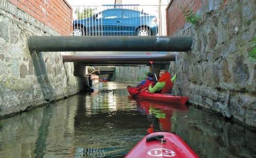 Island. The banks of the lake are overgrown with reeds and inaccessible. The only access to the riverside is on the eastern bank, where you can find narrow passages through the reeds.
4.7 km You go past a small, tree-clad islet with the flock of cormorants. You flow east along a lake narrowing between an immense WIELIMSKA Island and the southern lakeshore. 5.7 km You pass by a platform and the island buildings. WIELIMSKA Island, which covers the area of 96.13 ha, is the biggest midlake island in Poland. In the central part of the island, there are breeding ponds. Behind the island you can spot the main, almost boundless surface of the lake. WIELIMIE Lake (132.6 m above sea level; area:1754.6 ha; depth: 5.5m; width:6.4 km; max. width: 5.0 km) is the biggest water reservoir in the vicinity of Szczecinek. The GWDA River crosses through the lake. Seven islands on the lake make its enormous water surface more varied. The lake is rich in perch pikes, pikes, eels and breams. The western and the majority of southern reedy banks provide excellent living and breeding conditions for waterfowl. Along the eastern bank, north of the village of GWDA WIELKA, there are long natural sandy beaches with a municipality’s campsite. Sandy riverbed, small depth (medium depth: 1.9 m), and immense water surface provide excellent sailing and windsurfing conditions. Originally, the water surface of the lake was bigger. 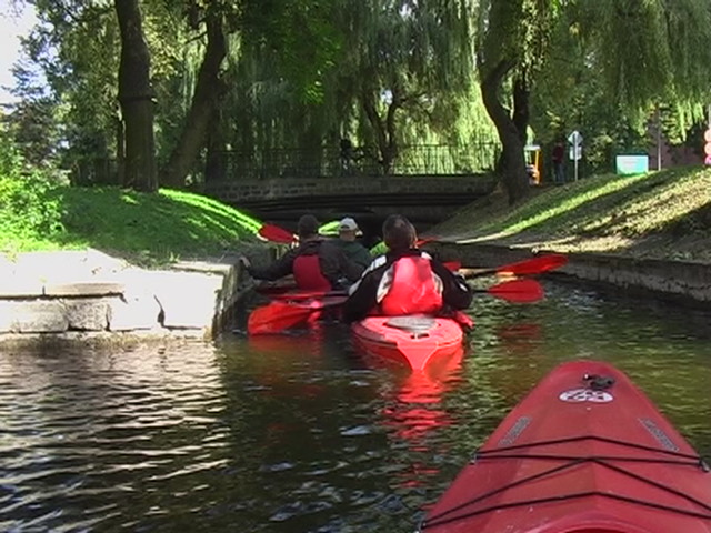 But, in order to expand agricultural areas, the surface of the lake was lowered twice in the 18th and 19th century. The lake is situated on the POMMERNSTELLUNG fortifications lane. Southwest and northeast to the lake, you will spot ferroconcrete bunkers connected by trenches.
9.2 km The GWDA River flows out from WIELIMIE Lake between two stone bridgeheads. 10.1 km A regulated stream of the GWDA River flowing through fields and meadows leads you to a road bridge in GWDA WIELKA village. Just before the bridge, on a sandy bank, there is a good starting and finishing point for excursions on the „SZCZECINEK LOOP” trail. The grocery is on the right bank next to an asphalt road- Jeziorna Street 33; 78-422 GWDA WIELKA, tel. (0-94) 375 70 75. There are three more groceries in the center of the village. 10.2 km Just behind the bridge on the right bank, there is a fishing harbor.
10.6 km On the edge of GWDA WIELKA village you have to overcome the upstream of the outflowing DOŁGA River. The sandy riverbed is wide here and the water is crystal clear. After 50-metre paddling, you reach a river barrier and the fence of a trout farm established in the 1960’s. The company responsible for breeding the trout is “GWDA” Breeding Fish Farm in GWDA WIELKA. Just before the barrier, on the eastern bank of the river, you have to transport canoes for 300 meters along the fence and across a wooden foothold over the DOŁGA River.
10.9 km Next to the foothold, there is a small water swelling, the only remnant of an old water mill. You launch again 30 meters behind the bridge, on a calm swelled waters of the DOŁGA river. You slowly go upstream. Paddle carefully taking into account the breeding and avoid lifting the bottom sludge. 12.8 km Close to a sandy basin with a wooden platform in the vicinity of the forest, the current of the DOŁGA River gets faster. The unsurfaced field way leads south to the village of GWDA MAŁA 0.5 km away. The SZCZECINEK-SŁUPSK railway road passes through the village railway station. 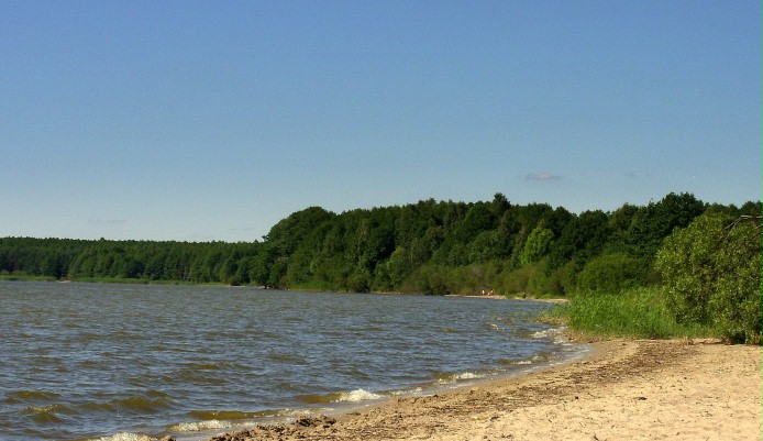
Going further under the canopy of alders, you immerse into a pine forest. A rapid and shallow flow of the river forces you to drag your canoe. 13.5 km You reach a beautiful mid-forest nook. An earth dam with a water gate swells the waters of the DOŁGA river towards DOŁGIE Lake. It forms a small overflow area suitable for a stop over or a bath. Transport canoes for 15 meters over the dam along the right bank. The dam with its water gate and the system of canals were built in 1973 to provide water the breeding ponds north to the river. You enter a narrowing overflow area that takes you to a mysterious flooded forest. You encounter broken trunks standing out of the water.
14.6 km You stream through a ford in a forest valley. There used to be a wooden bridge here. 15.7 km Going through riverside rushes, you finally reach an open space of unusual DOŁGIE Lake. DOŁGIE Lake with its clear waters (137.4 m above sea level; area: 310.8 ha; depth: 19.8 m; length: 8.5 km; max. width: 0.8 km) spans over an extremely deep and narrow postglacial channel. This fascinating lake is surrounded by variable landscape with impressive high banks covered with evergreen coniferous forests. The DOŁGA River flows along the whole lake. The inaccessible banks of the lake are steep and covered with reeds. However, you can find some passages through which you can get out and pitch a tent.
17.1 km On the third cape on the western bank, there is the first forest campsite of Szczecinek Forest Services. 17.5 km The second forest campsite known as “PATELNIA” and run by Szczecinek Forest Services, is situated on the eastern bank. A narrow passage through rows of reeds leads you to a mid-forest opening on a high slope of the lake valley. 17.9 km On the fourth cape on the western bank of DOLGIE Lake, there is the third campsite “BUNKRY” also run by Szczecinek Forest Services. The POMMERNSTELLUNG fortifications run here and you can spot concrete bunkers on a high bank.
18.4 km Another campsite of Szczecinek Forest Services is situated on the eastern bank of the lake at a small bay. 19.1 km The forest wall ends on the eastern bank. Along the high lakeshore, you can see buildings of a small holiday village DOLGIE. Below the power line hanging over the lake, there is a bathing place. Going further along a treeless bank, you encounter a private campsite. 24.2 km In the northwestern end of DOŁGIE Lake among the reeds you can find an estuary of the DOŁGA River flowing out from MŁYŃSKIE (STĘPINSKIE) Lake. Now you go upstream along a calmly meandering, 3 or 4-metre-wide DOŁGA River.
24.6 km Carry your canoes for 10 meters above a concrete platform across wide road. Further on, the DOŁGA River flows along an unregulated deep and wide valley with a treeless bed. The slopes are covered with a pine forest. The river runs along a row of alders, gets narrowed to 3 meters and then to less then 2 meters. The water surface might be low here, so be prepared to tow your canoe.
27.1 km In STĘPNO settlement the river narrows down and its current becomes faster. As the bed is stony and the and the water level is low, you are forced to tow your canoe. There used to be a water mill and a water-power plant here, but nowadays the only obstacle to overcome is a bridge with a concrete culvert. You can two y our canoes under the bridge or transport them on the left bank along a soil-surfaced road. The road leads to the village of STEPIEN located 1.5 km away. 27.2 km A wide outflow of the DOŁGA River from MŁYNSKIE Lake leads you to an open water surface. MŁYŃSKIE Lake (139.8 m above sea level; area: 41.7 ha; depth: 33.1 m; length: 1.4 km; max. width: 0.4 km) is surrounded by lakeside heights. Their western slopes are afforested.
27.5 km You go through a narrow reed-covered passage of MŁYNSKIE Lake. 27.9 km In the middle of the eastern right bank, between the reeds, there is a metal platform. An agritourism farm with a campsite situated on the bank is hidden over a small hillock. The owner, Mr. Marek Wójciszyn, offers accommodation and horse-riding facilities. Address: STEPIEN 14a, tel. (0-94) 375 72 27. 28.3 km Before reaching the immense reed field, stop over on a small forest clearing on the left northwest bank of MLYNSKIE Lake. Carry canoes for 400 meters along a forest path towards the crossroads and further  along a pathway towards DEBNO (DAMSKIE) Lake. 28.8 km 50 meters away from launching on the left bank, there is a forest clearing with a sandy access to waters. There is also a campsite run by Szczecinek Forest Services. The irregular-shaped DĘBNO Lake (140.2 m above sea level; area: 71.1 ha; depth 15.0 m; length: 1.8 km; max. width: 0.7 km) is hidden among forests in a deep post-glacial valley. The eastern bank is overgrown with reed. Along the southern bank, there are passages leading to the mainland. In the western end, you can relish water gardens of water lilies. A huge DĘBOGÓRA moraine range in the north, whose highest point is at 167.5 m above sea level, changes the direction of the lake valley. From a mid-lake passage, you should go towards the furthest northern bay of DEBNO Lake.
29.9 km You reach the base of a steep slope of a post-glacial DĘBOGÓRA massif covered with a pine forest. Get ready for 450-metre-long canoe transport. From a sandy exit from the lake, a forest pathway leads up the slope towards the hill ridge. It crosses two soil-surfaced roads. The forest road leads you on the opposite north slope. Beneath, you can spot a sparkling zigzag of ŁĄKIE Lake (139.7 m above sea level; area: 14.7 ha; depth: 6.0 m; length: 0.9 km; max. width: 0.15 km). The lake is situated in a postglacial valley. At the beginning of LAKIE Lake, on the southeast bank, there is a sandy water access. You paddle through the narrow lake with its inaccessible banks covered with reeds and bulrush.
31.3 km On the edge of the forest, at the end of ŁĄKIE Lake, there is an outflow of a watercourse hidden between water plants. You row through a slightly deeper valley. The changing current runs across fields and meadows. The narrow banks (width below 2 meters) are covered with grass. 32.6 km You paddle under a concrete road bridge across an asphalt road from STARE WIERZCHOWO to DRĘŻNO. 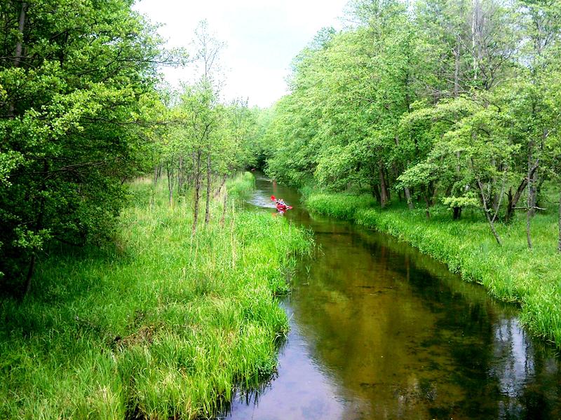
32.8 km Having gone past an alder forest, you reach an open surface of STUDNICA (DRĘŻNO) Lake. In this part, the banks of the lake are low and surrounded by rows of reeds. The GWDA River begins in STUDNICA Lake (139.4 m above sea level; area: 101.7 ha; depth: 24.9 m; length: 2.1 km; max. width: 0.8 km). On the eastern lake bank, on the outskirts of DREZNO village, there is the Zdzislaw Pilawa Scout Hostel, 78-400 Szczecinek, ul. Mickiewicza 2, tel. (0-94) 374 23 05. They offer access to a campsite, holiday homes, canteen, showers and bathing beach with a platform. There is a grocery in the village. Two canoeing trails: “GWDA” and “SZCZECINEK LOOP” meet on STUDNICA Lake and run on together. In the middle of the lake, the banks become high and they are covered with a coniferous forest.
34.8 km The estuary of the GWDA River to STUDNICA Lake is on the left to the O.W “ORAWKA” Holiday Center, tel. (0-94) 375 77 94; Koszalin: tel. (0-94) 345 14 74. The center offers holiday homes and paddling & swimming equipment. You go under a concrete bridge in the holiday village of ORAWKA situated on the passage between STUDNICA and WIERZCHOWO lakes. Just behind the bridge, there are campsites on both banks of the GWDA River. The campsites are run by Szczecinek Forest Services. 34.9 km A shallow sandy passage leads to an immense surface of mysterious ground moraine lake called WIERZCHOWO Lake (139.0 m above sea level; area: 731.0 ha; depth; 26.5 m; length: 5.2 km; max. width: 2.3 km). Baltic whitefish and vendaces are common in the lake.
35.6 km You paddle south along the eastern bank. Behind the only island on WIERZCHOWO Lake, there is the tree-clad DRAWSKA GÓRA Hill (166.6 m above the sea level) that overwhelms the area. An embankment of a well-preserved upland settlement dating back to the 8th – 9th century adjoins the hill. The “PIASKI” campsite, run by Szczecinek Forest Services, is located the pine forest at the base of DRAWSKA GÓRA Hill. Along the shore, you will spot a belt of natural sandy beach. 37.6 km The GWDA River outflow is situated at the mouth of an immense bay in the southern part of the lake, behind a narrow lane of reeds. The fast current of the river tosses canoes among erratic boulders and under the remains of a concrete gate. On the left bank, there is a forest clearing with a municipality’s campsite.
38.9 km A wide and regulated GWDA bed leads under a semicircle-shaped stone road bridge in the village of STARE WIERZCHOWO. Both banks of the river are convenient enough to have a short stop over. 100 meters away on the left bank there’s a grocery. The second one is located 300 meters away, next to a church. Behind the village, the river submerges into an immense forest.
41.1 km GWDA enters a forest lake SMOLĘSKO (SMAUSZ) (138.3 m above sea level; area: 60.0 ha; depth: 4.0 m; length: 2.1 km; max. width: 0.3 km) The lake surface reaches SMOLĘSKA GÓRA Hill in the west and JAMIEŃSKIE MOUNTAINS in the east (168 m above sea level). In the western end, you can delight in above water gardens of water lilies. 41.6 km At the estuary of the GWDA River from SMOLĘSKO Lake on the left there is a forest clearing with a sandy access to the mainland. It is a convenient place for a short stop over. From the clearing, the road leads to a 200-metre-away holiday village of MALECHOWO.
41.7 km You go between three lines of wooden piles, the remains of an old wooden bridge. The trail runs along the lane of waterside hazels and alders. The stillness of the forest, this deserted area and the high slopes of JAMIEŃSKIE MOUNTAINS build up the mysterious atmosphere of this place. 42.8 km Be careful, as the current is fast, the bed is stony and you can overturn on the stage of fall at the concrete bridge. If the water level is low, put your canoes on the water and let them flow between the boulders protruding from water. You leave the forest behind the water gate and enter swampy meadows of MALECHOWSKIE BŁOTA (MALECHOWSKIE MARSHES).
46.5 km Near the first buildings of a holiday village called SPORE, paddle under a concrete road bridge. The asphalt road leads to SZCZECINEK, only 15 km away from this place. Behind the bridge on the right bank there is a convenient place for a short break. In the center of the village, there are two groceries and a mini-bar. You can find accommodation in SPORE village which is situated on the eastern bank of SPORE Lake (137.9 m above the sea level; area: 90.0 ha; depth: 7.4 m; length: 2.8 km; max. width: 0.5 km). You can choose between O.W. “SPORE 51” Holiday Center with holiday homes, tel. 0-502 79 22 7 7 and “ALEX” agritourism farm, tel. (0-94) 372 72 67, SPORE 50. 46.6 km On the left bank, 150 meters behind the bridge, there is a passage in a metal fence. It’s the entrance to the O.W. “Wodnik” campsite, tel. (0-94) 372 73 00; 0-604 18 77 44. The campsite offers holiday homes, a canteen, a day-room facilities and a bathroom. Having left the village, you enter high and mild slopes of a postglacial vale. It is a starting point of the upper gorge of the GWDA River.
47.5 km The slow current of the river takes you to a concrete road bridge next to a stage of fall. There are also foundations of an old now non-existent water mill. Carry canoes for 25 meters behind the stage of fall. On the left bank behind the water swelling and in front of the forest there is a campsite run by Szczecinek Forest Services. A stony road leading to nearby village of SPORE and through crossroads near DOBROGOSZCZ passes through slopes of a picturesque valley. Behind the stage of fall, the current is faster and the river bed is sandy. The GWDA River enters a coniferous forest. Locally high and versatile bank is covered with alders and poplars. Lumbered trunks of trees refresh the atmosphere on this trail. 48.2 km You paddle between granite boulders near the bridgeheads of an old bridge. Next to the right bridgehead, there are two huge yet slender spruces. Lumbered trunks sticking out of water make this place even more attractive. Then the current becomes slower.
49.0 km This is the end of the upper gorge of the GWDA River. The banks are lower and they are occupied by swampy alders. 50.3 km Among swampy banks covered with reeds, the GWDA River enters a ground moraine lake WIELIMIE, which is the biggest lake of the DRAWSKIE LAKE DISTRICT. You go south along the western shore of the lake.
51.7 km Opposite the first island, on the forest clearing on a western shore, you can spot a campsite run by Szczecinek Forest Services. 54.5 km Going along immense reeds, you finally reach a small islet situated at the exit of a narrowing between WIELIMSKA Island and long rows of bulrushes. Going southeast, you reach a 4-kilometre-away village of GWDA WIELKA. The simpler version of the canoeing trail leads you westwards and then southwards through a water narrowing. 56.5 km Behind WIELIMSKA Island you go past an island with a flock of cormorants. You go southwest towards the base of the bay and the outflow of the NIEZDOBNA River.
58.7 km From a swampy estuary of the NIEZDOBNA River to WIELIMIE Lake on the border of the town of SZCZECINEK, you paddle upstream along a slow current.
59.9 km Having passed the 4th bridge in SZCZECINEK, carry y our canoes for 15 meters on the left bank. 60.2 km If the water level is high, transport canoes for 8 meters on the left before reaching the 5th bridge. The low-hanging pipes make it impossible to pass here. The current of the river which flows here between town buildings is quite fast and sometimes you have to tow your canoe.
60.9 km To overcome the last pipe-like obstacle on the trail, you have to transport canoes along a specially designed steel platform. In the park area the current of the NIEZDOBNA River is slow again. 61.1 km Next to the castle complex, we reach an open surface of TRZESIECKO Lake.
61.4 km You reach the town beach which is the starting and the finishing point of „SZCZECINEK LOOP” trail.

